Herméville-en-Woëvre | |
|---|---|
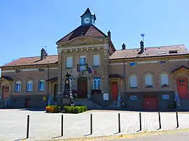 The town hall in Herméville-en-Woëvre | |
.svg.png.webp) Coat of arms | |
Location of Herméville-en-Woëvre | |
 Herméville-en-Woëvre  Herméville-en-Woëvre | |
| Coordinates: 49°10′46″N 5°35′36″E / 49.1794°N 5.5933°E | |
| Country | France |
| Region | Grand Est |
| Department | Meuse |
| Arrondissement | Verdun |
| Canton | Étain |
| Intercommunality | CC du pays d'Étain |
| Government | |
| • Mayor (2020–2026) | Evelyne Valencin[1] |
| Area 1 | 14.64 km2 (5.65 sq mi) |
| Population | 225 |
| • Density | 15/km2 (40/sq mi) |
| Time zone | UTC+01:00 (CET) |
| • Summer (DST) | UTC+02:00 (CEST) |
| INSEE/Postal code | 55244 /55400 |
| Elevation | 199–223 m (653–732 ft) (avg. 207 m or 679 ft) |
| 1 French Land Register data, which excludes lakes, ponds, glaciers > 1 km2 (0.386 sq mi or 247 acres) and river estuaries. | |
Herméville-en-Woëvre (French pronunciation: [ɛʁmevil ɑ̃ wavʁ]) is a commune in the Meuse department in Grand Est in north-eastern France.
See also
References
- ↑ "Répertoire national des élus: les maires". data.gouv.fr, Plateforme ouverte des données publiques françaises (in French). 9 August 2021.
- ↑ "Populations légales 2021". The National Institute of Statistics and Economic Studies. 28 December 2023.
Wikimedia Commons has media related to Herméville-en-Woëvre.
This article is issued from Wikipedia. The text is licensed under Creative Commons - Attribution - Sharealike. Additional terms may apply for the media files.