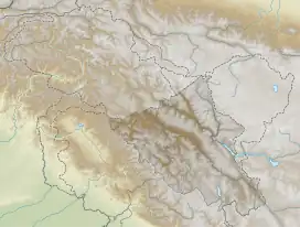
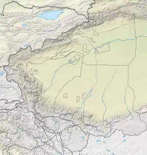
| Jeong Nala Jiwan Nala, Nacho Chu | |
|---|---|
 Location of the mouth  Jeong Nala (Southern Xinjiang) | |
| Location | |
| Countries | China and India |
| Provinces | Xinjiang and Ladakh |
| Physical characteristics | |
| Source | |
| • location | Aksai Chin |
| • coordinates | 35°03′58″N 78°31′58″E / 35.0661°N 78.5329°E |
| • elevation | 5,500 metres (18,000 ft) |
| Mouth | |
• location | Shyok River |
• coordinates | 34°59′33″N 77°59′56″E / 34.9925°N 77.9989°E |
• elevation | 4,400 metres (14,400 ft) |
| Length | 50 kilometres (31 mi) |
| Basin features | |
| Progression | Murgo Nala, Shyok River |
| River system | Indus River |
The Jeong Nala, also called Jiwan Nala[1] and Nacho Chu,[2] and called Xidagou (Chinese: 西大沟; pinyin: Xī dà gōu) by China, a tributary of the Shyok River (which in turn is a tributary of Indus River), flows from the disputed Aksai Chin region administered by China to Ladakh in India. It originates at the eastern edge of the Karakoram Range and flows west. It finally confluences in the Indian administered area with the Burtsa Nala on Darbuk–Shyok–DBO Road (DSDBO Road), and Burtsa Nala itself falls into Shyok River after flowing 7 km south. After the confluence of Jeong Nala with Burtsa Nala, the entire course of river flows along the DSDBO Road to Shyok village.

Geography
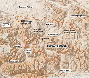
The Jeong Nala is to the south of Depsang Plains, with the Chip Chap River flowing through it, and the Depsang Bulge, which houses the valley of the Raki Nala. All the three rivers are tributaries of the Shyok River.
Just 10 kilometres (6.2 mi) to the south of Jeong Nala, the Karakash River flows east, while Jeong flows west. China's Heweitan military base is situated on the bank of Karakash, which is also able to strategically control the valley of the Jeong Nala. The Tiankong Highway connecting Heweitan and Tianwendian bases passes through the Jeong valley. China also has constructed a motorable road in the Jeong valley to access the Line of Actual Control with India.
See also
Notes
- ↑ The Line of Actual Control is that marked by the contributors to the OpenStreetMap as of January 2021, and may not be accurate. Chinese claims get more readily represented on the OpenStreetMap than other countries.[3]
References
- ↑ Bhattacharji, Ladakh (2012): "It is mispronounced—or perhaps deliberately changed—as ‘Jiwan’ by both Indian soldiers posted there and visiting surveyors; it makes for another example of thoughtless deculturisation of Ladakh being committed by people from the plains."
- ↑ Sandhu, P. J. S.; Shankar, Vinay; Dwivedi, G. G. (2015), 1962: A View from the Other Side of the Hill, Vij Books India Pvt Ltd, p. 53, ISBN 978-93-84464-37-0: "By 24 Oct [1962], all the forward posts established in the Chip Chap and Nachu Chu river valleys had been withdrawn. DBO was also abandoned. 14 J&K Militia continued to hold Saser Brangsa, Murgo, Sultan Chushku and the junction of the Galwan and Shyok rivers."
- ↑ Vittoria Elliott, Nilesh Christopher, The mysterious user editing a global open-source map in China’s favor, Rest Of World, 29 March 2021.
- ↑ India, Ministry of External Affairs, ed. (1962), Report of the Officials of the Governments of India and the People's Republic of China on the Boundary Question, Government of India Press, Chinese Report, Part 1 (PDF) (Report). pp. 4–5.
The location and terrain features of this traditional customary boundary line are now described as follows in three sectors, western, middle and eastern. ... The portion between Sinkiang and Ladakh for its entire length runs along the Karakoram Mountain range. Its specific location is as follows: From the Karakoram Pass it runs eastwards along the watershed between the tributaries of the Yarkand River on the one hand and the Shyok River on the other to a point approximately 78° 05' E, 35° 33' N, turns southwestwards and runs along a gully to approximately 78° 01' E, 35° 21' N; where it crosses the Chipchap River. It then turns south-east along the mountain ridge and passes through peak 6,845 (approximately 78° 12' E, 34° 57' N) and peak 6,598 (approximately 78° 13' E, 34° 54' N).
Bibliography
- Bhattacharji, Romesh (2012), Ladakh: Changing, Yet Unchanged, New Delhi: Rupa Publications – via Academia.edu