Murgo | |
|---|---|
Village | |
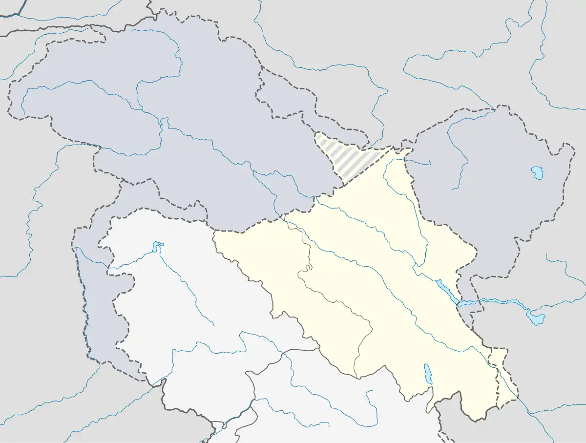
 Murgo Location in Ladakh, India  Murgo Murgo (India) | |
| Coordinates: 35°02′28″N 77°56′13″E / 35.04111°N 77.93694°E | |
| Country | |
| Union Territory | Ladakh |
| District | Leh |
| Tehsil | Nubra |
| Elevation | 4,500 m (14,600 ft) |
| Languages | |
| Time zone | UTC+5:30 (IST) |
| ISO 3166 code | IN-LA |
| Vehicle registration | LA |
Murgo, on "Murgo Nala"[2] near Murgo Hotspring,[3] is a small hilly village which lies near the Line of Actual Control in Leh district of the union territory of Ladakh in India, close to Chinese-controlled Aksai Chin. It is one of the northernmost villages of India.[4] The Murgo Gompa is a large Buddhist monastery at Murgo.[5] Murgo lies on the Darbuk–Shyok–DBO Road (DS-DBO Road) and Sasser Brangsa-Murgo Road (SBM Road) fork of Sasoma–Sasser La-Saser Brangsa-Gapsam-Daulat Beg Oldi Road (SSSG-DBO Road), both of which connect Leh to Daulat Beg Oldi.[6] The village is inhabited by a small civilian population of Baltis,[7] who make a living by apricot farming and yak rearing. [4] The temperature plummets as low as -30 C in the winters. The weather deteriorates frequently with strong icy winds lashing much of Murgo. Murgo has very little vegetation or wildlife.[4] Telecommunication at Murgo is only available through INMARSAT satellite phones. The Indian Armed Forces have significant presence in the area.

Etymology
The name "Murgo" means "gateway of hell" in Tibetic languages.[8] Record from the 1840s indicates the Turkic name was Murgai and Tibetan name was Murgo-Chumik.[9] (Chumik means spring.[10]) "The gateway of death" meaning for Murgo is attributed because the route between Murgo and Karakoram Pass is through a dangerous desolate barren gorge at a height of 15,000 ft which frequently experiences snowstorms, gales and blizzards which every year caused deaths of thousands of men and animals of ancient caravans on this route.[11]
History
Murgo was a campsite on the difficult caravan route through Karakoram Pass,[12] the last place with sufficient vegetation for fuel and grass.[9] Czech paleontologist and biologist Ferdinand Stoliczka died here in 1874 during an expedition.[13] A memorial was erected for him in the Moravian cemetery at Leh, which still stands today. He was part of Thomas Douglas Forsyth's Lahore to Yarkand expedition.[14]

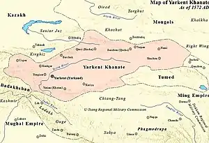
Murgo has the ruins of an ancient breastwork fortification wall (fortification of earthwork piled up to breast height to provide protection to defenders shooting over it from a standing position), which runs along the high hill to the cliff which drops to the river. It was built nearly 400 years ago by the governor of Nubra against the invasions from Tibet. Nearly 100 years later, the Tibetan ruler Sultan Said Khan (r. 1514-1533) of Yarkent Khanate demolished it. Remnants can still be seen.[3]
Geography
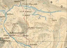
Murgo has Depsang Plains in the north, Depsang Bulge (Burtsa Bulge) in the east, Chang Chenmo River in the southeast, Sultan Chusku Caravan site in the south, and Sasser Pass in the west.
Murgo, at an altitude of 14,600 ft, is barren land in the valley surrounded with black and brown mountains. It has a fresh mineral water spring.[11]
"Murgo Nala" confluences with the Burtsa Nala. The Burtsa Nala, after receiving waters of north-to-south flowing Depsang Nala, flows west to join the west-to-east flowing "Murgo Nala" near Murgo and eventually drains into the Shyok River further south.[2] Saser Brangsa to Murgo route along the Murgo Nala is the Sasser Brangsa-Murgo Road (SBM Road) fork of Sasoma–Sasser La-Saser Brangsa-Gapsam-Daulat Beg Oldi Road (SSSG-DBO Road). The present route of SBM Road was traditionally the summer route from Saser Brangsa (and beyond from Gapshan, DBO, Karakoram Pass to Yarkand) to Shyok village, which goes over the Shyok River by crossing it near Saser Brangsa, into the Murgo Nala valley to Chongtash Lake & "Chongtash Camp" near the large boulder brought by the glacier, Murgo, Sultan Chusku and Shyok village. The winter route from Saser Brangsa to Shyok village, goes along the Shyok River without crossing it, to Sultan Chusku and Shyok village. These routes, part of the ancient silk route, are littered with the ancient skeletal remains of mules and camels as well as the partially decomposed ancient human bodies. The camels were brought here by the Yarkandi invaders.[14]
"Murgo Hotspring" has a local Ladakhi legend, that in a war fought here the Ladakhis pushed the Mongol invaders beyond the Depsang La. To wash their blood soaked hands, the Ladakhi warrior pierced the mountain with an arrow, causing the hot water to gush out.[3]
Nearby Burtse area has 40 million years old marine fossils when this area was under the Tethys Sea, including the fossils of gastropods (snail-like mollusks), bivalves (shellfish) and foraminifera (mostly microscopic organisms).[15]
Murgo Gompa
The Murgo Gompa is a sub-monastery of Yarma Gompa of Drukpa Kagyu lineage. The senior to lower hierarchy of gompa administration is the Lopon, Gye-nyen, Geylong, Gye-tsul, and cun-zung.[5]
See also
References
- ↑ Indian Mountaineer. Indian Mountaineering Foundation. 1983.
At the extreme right corner of this 6 km long ground is a place called Murgo (14,600ft), situated on the bank of a tributary known as Burtsa nalla.
- 1 2 Burtsa Nala basin, OpenStreetMap, retrieved 23 June 2021.
- 1 2 3 Harish Kohl, 2000, Across the Frozen Himalaya: The Epic Winter Ski Traverse from Karakoram to Lipu Lekh, page 75.
- 1 2 3 "Lost in Dispute: 7 Beautiful Places near India-China Border". trodly.com. Retrieved 1 September 2023.
- 1 2 Prem Singh Jina, 2009, Cultural Heritage of Ladakh Himalaya, p 114.
- ↑ Singh, Rahul; Choudhury, Sunetra (29 September 2023). "India moves to secure key flashpoint at LAC". Hindustan Times. Retrieved 1 October 2023.
- ↑ PTI (19 April 2013). "Chinese troops intrude into Indian territory in Ladakh, erect a tented post". The Economic Times. Retrieved 2 January 2020.
The nearest inhabited town is Murgo to the south, which has a small population of Baltis who primarily depend on apricot farming and yak rearing.
- ↑ Kapadia, Harish (1999). Across Peaks & Passes in Ladakh, Zanskar & East Karakoram. Indus Publishing. pp. 229–230. ISBN 978-81-7387-100-9.
Once down in Ladakh even lama scholars far away at Darjeeling also gave the same interpretation of the names as a Ladakhi ... Murgo: gateway of hell. (Mur: hell, go: gate).
- 1 2 Thomson, Thomas (1852). Western Himalaya and Tibet: A Narrative of a Journey Through the Mountains of Northern India, During the Years 1847-8. Reeve and Company. pp. 422–424.
The encamping-ground is called by the Turki merchants Murgai, by the Tibetans, Murgo-Chumik ... It was the last place at which I was to expect a sufficiency of fuel ... or grass ... A number of springs appeared to break out of the ground close to my tent
- ↑ American Alpine Club. 1975 American Alpine Journal. The Mountaineers Books. p. 57. ISBN 978-1-933056-30-2.
Chumik: "spring" from chhu (water) + mik (eye)
- 1 2 "Murgo: Indian Himalayas".
- ↑ thinkquest.org (26 November 2005). "Murgo". thinkquest.org. Archived from the original on 9 September 2013. Retrieved 26 November 2005.
It is rightly named as the route beyond Murgo, towards the Karakoram Pass, passes through a desolate barren gorge ... Murgo is a camping site.
- ↑ Kapadia (2005). Into the Untravelled Himalaya: Travels, Treks, and Climbs. Indus Publishing. p. 212. ISBN 978-81-7387-181-8.
There was a memorial to Ferdinand Stolickzka ... He died at Murgo on 19 July 1874, and a tower has been erected here in his memory.
- 1 2 Harish Kapadia, 1999, Across Peaks & Passes in Ladakh, Zanskar & East Karakoram, p 116.
- ↑ Geologist finds marine fossils at icy heights in Ladakh, Hindustan Times, 30 aug 2023.