Dargeçit | |
|---|---|
District and municipality | |
 | |
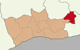
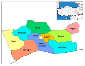
 Map showing Dargeçit District in Mardin Province | |
 Dargeçit Location in Turkey | |
| Coordinates: 37°32′38″N 41°43′12″E / 37.544°N 41.720°E | |
| Country | Turkey |
| Province | Mardin |
| Area | 519 km2 (200 sq mi) |
| Elevation | 940 m (3,080 ft) |
| Population (2022)[1] | 27,147 |
| • Density | 52/km2 (140/sq mi) |
| Time zone | TRT (UTC+3) |
| Area code | 0482 |
Dargeçit (Kurdish: Kerboran[2]), (Syriac: ܟܦܪ ܒܘܪܢ, romanized: Kfar Buran) is a municipality and district of Mardin Province, Turkey.[3] Its area is 519 km2,[4] and its population is 27,147 (2022).[1] The town is principally populated by Kurds of the Erebiyan tribe.[5]
History
In the nineteenth century, all the urban settlements in this zone, including Midyat and Kerboran, as well as Mardin and a lot of villages around them and in the Tur Abdin area were populated by Assyrian-Syriac Christians.[6][7]
The district Dargeçit was established in 1987.[8] Since the 2013 administrative reform, Dargeçit is a metropolitan district and municipality. Prior to the reform, the district comprised the main town of Dargeçit (four neighbourhoods: Bahçebaşı, Safa, Saray and Tepebaşı), two towns (Kılavuz and Sümer), thirty-six villages and twenty-six hamlets.[9]
Composition
There are 41 neighbourhoods in Dargeçit District:[10]
- Akçaköy (Îzar)
- Akyol (Derêca)
- Alayunt (Arbayê)
- Altınoluk (Gera Cafer)
- Altıyol (Serdef)
- Bağözü (Trîwa)
- Bahçebaşı
- Batur (Batêr)
- Baysun (Êzdîna)
- Beğendi (Gizre)
- Belen (Bakvan)
- Bostanlı (Wersikê)
- Çatalan (Deyrik)
- Çatalçam (Dayro da-Slibo)
- Çavuşlu (Zêwkê)
- Çelikköy (Çêlik)
- Çukurdere (Gelîkur)
- Değerli (Îwan)
- Gürgen (Botijê)
- Gürışık (Gundê Xace)
- Ilısu (Germav)
- Karabayır (Zengan)
- Kartalkaya (Lîyan)
- Kılavuz (Xelilan)
- Kısmetli (Basiqil kêvil)
- Korucu (Şikeftika)
- Kumdere (Şibêbiyê)
- Kuşluca (Kopraz)
- Ormaniçi (Qawaqa)
- Safa
- Saray
- Suçatı (Kerbent)
- Sümer (Deywan)
- Tanyeri (Rover)
- Tavşanlı (Xirabê Qesrê)
- Temelli (Emara)
- Tepebaşı
- Ulaş (Dîlan)
- Yanılmaz (Guriza)
- Yılmaz (Mêranê)
- Yoncalı (Zivinga Çelik)
References
- 1 2 "Address-based population registration system (ADNKS) results dated 31 December 2022, Favorite Reports" (XLS). TÜİK. Retrieved 19 September 2023.
- ↑ Avcıkıran, Adem (2009). Kürtçe Anamnez, Anamneza bi Kurmancî. p. 55.
- ↑ Büyükşehir İlçe Belediyesi, Turkey Civil Administration Departments Inventory. Retrieved 19 September 2023.
- ↑ "İl ve İlçe Yüz ölçümleri". General Directorate of Mapping. Retrieved 19 September 2023.
- ↑ Tan, Altan (2011). Turabidin'den Berriye'ye & Aşiretler (in Turkish). Nûbihar. p. 110.
- ↑ Jongerden, Joost; Verheij, Jelle (2012-08-03). Social Relations in Ottoman Diyarbekir, 1870-1915. BRILL. pp. 24–25. ISBN 978-90-04-22518-3.
- ↑ https://dergipark.org.tr/en/download/article-file/276501
- ↑ "İl İdaresi ve Mülki Bölümler Şube Müdürlüğü İstatistikleri - İl ve İlçe Kuruluş Tarihleri" (PDF) (in Turkish). p. 62. Retrieved 27 December 2022.
- ↑ "Dargeçit Tarihçe" (in Turkish). Retrieved 3 October 2023.
- ↑ Mahalle, Turkey Civil Administration Departments Inventory. Retrieved 19 September 2023.
