Kilis Province
Kilis ili | |
|---|---|
 A stone house in Alahan, a village on the Syrian border | |
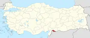 Location of the province within Turkey | |
| Country | Turkey |
| Seat | Kilis |
| Government | |
| • Vali | Tahir Şahin |
| Area | 1,412 km2 (545 sq mi) |
| Population (2022)[1] | 147,919 |
| • Density | 100/km2 (270/sq mi) |
| Time zone | TRT (UTC+3) |
| Area code | 0348 |
| Website | www |
Kilis Province (Turkish: Kilis ili) is a province in southern Turkey, on the border with Syria. Its area is 1,412 km2,[2] and its population is 147,919 (2022).[1] The province was created in 1995 from the southern part of Gaziantep Province.[3][4] The city of Kilis is home to over 75% of the inhabitants of the province; the other towns and villages are very small.
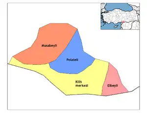
Districts
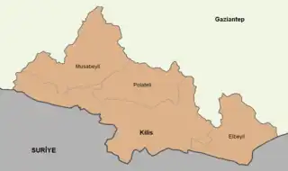
The province is divided into 4 districts, listed below with their official estimates of population as of 2022: Elbeyli District (5,594), Kilis District (the capital district) (125,079), Musabeyli District (12,390) and Polateli District (4,856).[5]
See also
References
- 1 2 "Address-based population registration system (ADNKS) results dated 31 December 2022, Favorite Reports" (XLS). TÜİK. Retrieved 19 September 2023.
- ↑ "İl ve İlçe Yüz ölçümleri". General Directorate of Mapping. Retrieved 19 September 2023.
- ↑ Karar Sayısı: KHK/550, Resmî Gazete, 6 June 1995.
- ↑ "İl İdaresi ve Mülki Bölümler Şube Müdürlüğü İstatistikleri - İl ve İlçe Kuruluş Tarihleri" (PDF) (in Turkish). p. 55. Retrieved 25 October 2023.
- ↑ "Address Based Population Registration System (ABPRS) - Results of 31 December 2022" (XLS). TÜİK. Retrieved 12 March 2023.
External links
Wikimedia Commons has media related to Kilis Province.
- (in Turkish) Kilis governor's official website
- (in Turkish) Kilis municipality's official website
- (in English) Kilis weather forecast information
This article is issued from Wikipedia. The text is licensed under Creative Commons - Attribution - Sharealike. Additional terms may apply for the media files.