| Koetoi River 声問川 | |
|---|---|
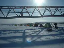
 Ice fishing for Wakasagi. (January 2004) | |
| Native name | Koetoi-gawa (Japanese) |
| Location | |
| Country | Japan |
| State | Hokkaidō |
| Region | Sōya |
| District | Wakkanai |
| Physical characteristics | |
| Source | Mount Etanpakku |
| • location | Wakkanai, Hokkaidō, Japan |
| • coordinates | 45°13′50″N 142°0′48″E / 45.23056°N 142.01333°E |
| • elevation | 313 m (1,027 ft) |
| Mouth | Sōya Bay |
• location | Wakkanai, Hokkaidō, Japan |
• coordinates | 45°24′27″N 141°45′20″E / 45.40750°N 141.75556°E |
• elevation | 0 m (0 ft) |
| Length | 41.9 km (26.0 mi) |
| Basin size | 294.8 km2 (113.8 sq mi) |
Koetoi River (声問川, Koetoi-gawa) is a river in Hokkaidō, Japan.
This article is issued from Wikipedia. The text is licensed under Creative Commons - Attribution - Sharealike. Additional terms may apply for the media files.