Template:Attached KML/LS postcode area
KML is from Wikidata
Leeds | |
|---|---|
 LS | |
| Coordinates: 53°49′23″N 1°33′14″W / 53.823°N 1.554°W | |
| Country | United Kingdom |
| Postcode area | LS |
| Postcode area name | Leeds |
| Post towns | 6 |
| Postcode districts | 32 |
| Postcode sectors | 150 |
| Postcodes (live) | 21,561 |
| Postcodes (total) | 31,805 |
| Statistics as at May 2020[1] | |
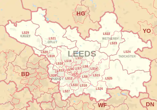
The LS postcode area, also known as the Leeds postcode area,[2] is a group of 29 postcode districts in England, within six post towns. These cover northern West Yorkshire (including Leeds, Wetherby, Pudsey, Otley and Ilkley) and some parts of North Yorkshire (including Tadcaster).
Coverage
The approximate coverage of the postcode districts:
Map
Template:Attached KML/LS postcode area
KML is from Wikidata
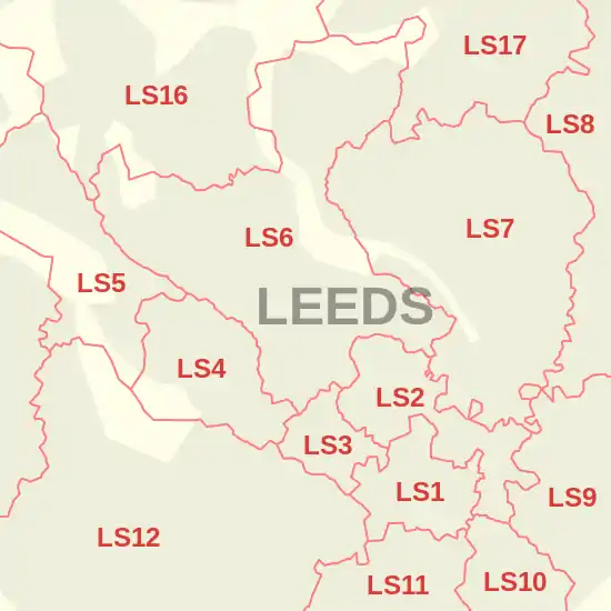
Detailed map of postcode districts in central Leeds
See also
References
- ↑ "ONS Postcode Directory Version Notes" (ZIP). National Statistics Postcode Products. Office for National Statistics. May 2020. Table 2. Retrieved 19 June 2020. Coordinates from mean of unit postcode points, "Code-Point Open". OS OpenData. Ordnance Survey. February 2012. Retrieved 21 April 2012.
- ↑ Royal Mail, Address Management Guide, (2004)
External links
This article is issued from Wikipedia. The text is licensed under Creative Commons - Attribution - Sharealike. Additional terms may apply for the media files.