Langsa | |
|---|---|
| City of Langsa | |
| Other transcription(s) | |
| • Jawoë | لڠسا |
 Flag  Coat of arms | |
| Motto(s): Indonesian: Terwujudnya Masyarakat yang Aman, Damai, Bermartabat, Maju, Sejahtera, dan Islami English: Realization of a Safe Community, Peace, Dignity, Progress, Prosperity with islamic values | |
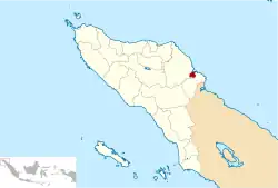 Location within Aceh | |
| Coordinates: 4°28′48″N 97°57′48″E / 4.48000°N 97.96333°E | |
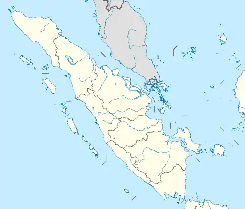
| Country | Indonesia |
| Region | Sumatra |
| Province | Aceh |
| City Established | 17 October 2001 |
| Government | |
| • Mayor | Usman Abdullah |
| • Vice Mayor | Marzuki Hamid |
| Area | |
| • Total | 239.83 km2 (92.60 sq mi) |
| Population (mid 2022 estimate) | |
| • Total | 192,630 |
| • Density | 800/km2 (2,100/sq mi) |
| [1] | |
| Time zone | UTC+7 (IWST) |
| Area code | (+62) 641 |
| Website | langsakota.go.id |
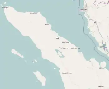

Langsa (Indonesian: Kota Langsa, Jawoë: لڠسا), is a city in Aceh, Indonesia. It is located on the island of Sumatra. Apart from a small seacoast to the northeast, it borders Manyak Payed District of Aceh Tamiang Regency to the east and is otherwise surrounded by Birem Bayeun District of Aceh Timur Regency (of which the city was formerly a part until 2001) to the north, west and south. The city covers an area of 239.83 square kilometres and had a population of 148,945 at the 2010 Census[2] (compared with 117,256 at the previous 2000 Census); this grew to 185,971 at the 2020 Census,[3] and the official estimate as at mid 2022 was 192,630, comprising 86,788 males and 95,842 females.[1]
Langsa is located 440 kilometres (273 miles) from the city of Banda Aceh, the province's capital. Langsa is close to its province's southern border and is 167 kilometres (103 miles) from Medan, the capital city of North Sumatra. This makes Langsa a strategic city for trade and traffic between the two provinces.[4]
There are several universities in the city of Langsa both state and private universities. Among them are Samudra University and IAIN Zawiyah Cot Kala, Campus LP3I. The city hosts several schools of nursing and midwifery, including the Academy of Nursing of "Harapan Ibu", the Academy of Nursing "Yayasan Cut Nyak Dhien" and the Academy of Nursing "UMMI".
History
Darul Islam Rebellion
On 21 September 1953, Darul Islam forces invaded Langsa. They attacked Military Police and Mobile Brigade barracks. TNI repelled DI/TII attack after receiving reinforcement troops from Medan.[5]
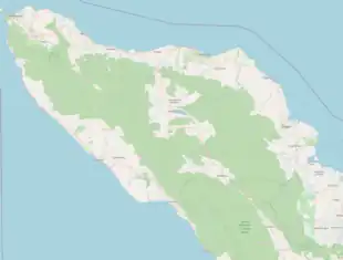
Administrative districts
The city is divided into five districts (kecamatan), tabulated below with areas and their population at the 2010[2] and 2020[3] Censuses, together with the official estimates as at mid 2022.[1] The table also includes the locations of the district administrative centres, the number of administrative villages in each village (urban gampong), and its postal codes.
| Kode Wilayah | Name of District (kecamatan) | Area in km2 | Pop'n Census 2010 | Pop'n Census 2020 | Pop'n Estimate mid 2022 | Admin centre | No. of villages | Post codes |
|---|---|---|---|---|---|---|---|---|
| 11.74.01 | Langsa Timur (East Langsa) | 78.23 | 13,818 | 16,627 | 17,152 | Seunebuk Antara | 16 | 24411 |
| 11.74.04 | Langsa Lama | 45.02 | 26,877 | 33,231 | 34,378 | Meurandeh | 15 | 24411 & 24416 |
| 11.74.02 | Langsa Barat (West Langsa) | 48.781 | 30,583 | 39,553 | 41,111 | Matang Seulimeng | 13 | 24410, 24413, 24414 & 24415 |
| 11.74.05 | Langsa Baro | 61.69 | 41,804 | 55,824 | 58,219 | Geudubang Aceh | 12 | 24415 |
| 11.73.03 | Langsa Kota (Langsa Town) | 6.11 | 35,863 | 40,736 | 41,770 | Gampong Teungoh | 10 | 24410, 24412, 24414 & 24416 |
| Totals | 239.83 | 148,945 | 185,971 | 192,630 | 66 |
Climate
Langsa has a tropical rainforest climate (Af) with moderate rainfall from February to April and heavy rainfall in the remaining months.
| Climate data for Langsa | |||||||||||||
|---|---|---|---|---|---|---|---|---|---|---|---|---|---|
| Month | Jan | Feb | Mar | Apr | May | Jun | Jul | Aug | Sep | Oct | Nov | Dec | Year |
| Mean daily maximum °C (°F) | 31.0 (87.8) |
32.0 (89.6) |
32.4 (90.3) |
32.5 (90.5) |
32.5 (90.5) |
32.4 (90.3) |
32.1 (89.8) |
32.0 (89.6) |
31.3 (88.3) |
31.1 (88.0) |
30.6 (87.1) |
30.7 (87.3) |
31.7 (89.1) |
| Daily mean °C (°F) | 26.6 (79.9) |
27.1 (80.8) |
27.4 (81.3) |
27.7 (81.9) |
27.8 (82.0) |
27.6 (81.7) |
27.2 (81.0) |
27.2 (81.0) |
26.9 (80.4) |
26.9 (80.4) |
26.5 (79.7) |
26.6 (79.9) |
27.1 (80.8) |
| Mean daily minimum °C (°F) | 22.2 (72.0) |
22.2 (72.0) |
22.4 (72.3) |
23.0 (73.4) |
23.1 (73.6) |
22.8 (73.0) |
22.3 (72.1) |
22.4 (72.3) |
22.6 (72.7) |
22.8 (73.0) |
22.5 (72.5) |
22.5 (72.5) |
22.6 (72.6) |
| Average rainfall mm (inches) | 149 (5.9) |
83 (3.3) |
85 (3.3) |
94 (3.7) |
179 (7.0) |
140 (5.5) |
160 (6.3) |
200 (7.9) |
233 (9.2) |
242 (9.5) |
237 (9.3) |
275 (10.8) |
2,077 (81.7) |
| Source: Climate-Data.org[6] | |||||||||||||
Population
Langsa's population is mainly made up of people of Acehnese, Malay, Javanese, Chinese, and Batak ethnicities. Acehnese is the main language used by people who consider themselves as of Acehnese ethnicity, but the Indonesian language is the official language.
Islam is the religion of the majority in Aceh, including Langsa, but other religions exist, such as Christianity and Buddhism. Buddhism is common among Langsa's ethnically Chinese population.
People from Langsa
- Jessica Mila
- Kivlan Zen
- Jusman Syafii Djamal
- Johannes Antonius Franciscus Roelen
- Peter Kuiper
- Jalwandi Jamal
References
- 1 2 3 Badan Pusat Statistik, Jakarta, 2023, Kota Langsa Dalam Angka 2023 (Katalog-BPS 1102001.1174)
- 1 2 Biro Pusat Statistik, Jakarta, 2011.
- 1 2 Badan Pusat Statistik, Jakarta, 2021.
- ↑ "Langsa profile in Kemendagri.go.id". Archived from the original on 2018-01-15. Retrieved 2016-08-09.
- ↑ van Dijk, Cornelis (1981). Rebellion under the Banner of Islam: The Darul Islam in Indonesia. The Hague: Martinus Nijhoff. p. 307.
- ↑ "Climate: Langsa". Climate-Data.org. Archived from the original on 15 September 2023. Retrieved 5 November 2020.
External links
- Kota Langsa Official Website
- Aceh Fair 2011 at the Wayback Machine (archived April 25, 2012)
- >> Instagram Photos Tags Kota Langsa
Regencies and cities of Aceh | ||
|---|---|---|
Capital: Banda Aceh | ||
| Regencies |  | |
| Cities | ||