Pidie Jaya Regency
Kabupaten Pidie Jaya | |
|---|---|
 Seal | |
| Motto(s): Peugah Lagë Buet, Peubuet Lagë Na (Say What you Do, Do What you Say) | |
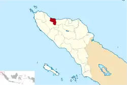 Location within Aceh | |
| Coordinates: 5°07′N 96°12′E / 5.117°N 96.200°E | |
| Country | |
| Region | Sumatra |
| Province | |
| Established | 2007 |
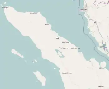
| Regency seat | Meureudu |
| Government | |
| • Regent | Teungkub Aiyub Ben Abbas |
| • Vice Regent | Said Mulyadi |
| Area | |
| • Total | 1,073.60 km2 (414.52 sq mi) |
| Population (mid 2022 estimate)[1] | |
| • Total | 162,711 |
| • Density | 150/km2 (390/sq mi) |
| Time zone | UTC+7 (IWST) |
| Area code | (+62) 653 |
| Website | pidiejayakab.go.id |
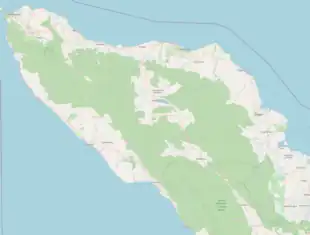
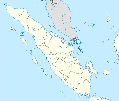

Pidie Jaya Regency (Indonesian: Kabupaten Pidie Jaya) is a regency in the Aceh Special region of Indonesia. It is located on the island of Sumatra. The regency was created out of the former northeast districts of Pidie Regency on 2 January 2007. The seat of the regency government is at Meureudu. The regency covers an area of 952.11 square kilometres and had a population of 132,956 people at the 2010 Census[2] and 158,397 at the 2020 Census;[3] the official estimate as at mid 2022 was 162,771 - comprising 80,946 males and 81,825 females.[1]
Administrative divisions
The regency is divided administratively into eight districts (kecamatan), listed below with their areas and their populations at the 2010 Census[2] and the 2020 Census,[3] together with the official estimates as at mid 2022.[1] The table also includes the locations of the district administrative centres, the number of administrative villages (gampong) in each district, and its post code.
| Kode Wilayah | Name of District (kecamatan) | Area in km2 | Pop'n Census 2010 | Pop'n Census 2020 | Pop'n Estimate mid 2022 | Admin centre | No. of villages | Post code |
|---|---|---|---|---|---|---|---|---|
| 11.18.01 | Meureudu | 124.79 | 18,387 | 22,226 | 22,903 | Kota Meureudu | 30 | 24186 |
| 11.18.05 | Meurah Dua | 287.07 | 10,090 | 12,507 | 12,951 | Meunasah Bie | 19 | 24186 |
| 11.18.04 | Bandar Dua | 174.32 | 23,656 | 28,060 | 28,810 | Ulee Gle | 45 | 24188 |
| 11.18.03 | Jangka Buya | 9.35 | 8,714 | 10,174 | 10,414 | Keude Jangka Buya | 18 | 24186 |
| 11.18.02 | Ulim | 41.75 | 13,338 | 16,242 | 16,761 | Keude Ulim | 30 | 24187 |
| 11.18.08 | Trienggadeng | 79.37 | 19,901 | 23,509 | 24,118 | Keude Trienggadeng | 27 | 24185 |
| 11.18.07 | Panteraja | 15.00 | 7,533 | 8,968 | 9,214 | Keude Panteraja | 10 | 24185 |
| 11.18.06 | Bandar Baru | 220.47 | 31,337 | 36,711 | 37,600 | Keude Leung Putu | 43 | 24184 |
| Totals | 952.11 | 132,956 | 158,397 | 162,771 | Kota Meureudu | 222 |
| District (kecamatan) | Land area (Km2) |
Sea area to 4 Mile limit (Km2) |
Total area (Km2) |
Percentage (%) |
District divisions |
Villages |
|---|---|---|---|---|---|---|
| Bandar Dua | 176.26 | - | 176.26 | 14.99 | 5 | 45 |
| Bandar Baru | 223.64 | 57.60 | 281.24 | 24.19 | 8 | 43 |
| Jangka Buya | 7.88 | 21.76 | 29.64 | 2.55 | 2 | 18 |
| Meurah Dua | 276.20 | 16.00 | 292.20 | 25.13 | 3 | 19 |
| Meureudu | 139.14 | 17.60 | 156.74 | 13.48 | 7 | 30 |
| Panteraja | 13.80 | 26.24 | 40.04 | 3.44 | 2 | 10 |
| Trienggadeng | 76.19 | 51.81 | 128.00 | 11.01 | 5 | 27 |
| Ulim | 40.89 | 19.84 | 60.73 | 5.22 | 5 | 30 |
See also
References
External links
Regencies and cities of Aceh | ||
|---|---|---|
Capital: Banda Aceh | ||
| Regencies |  | |
| Cities | ||
5°07′N 96°12′E / 5.117°N 96.200°E