Liberty County | |
|---|---|
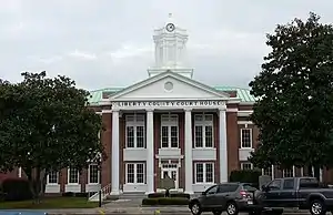 Liberty County Courthouse in Hinesville | |
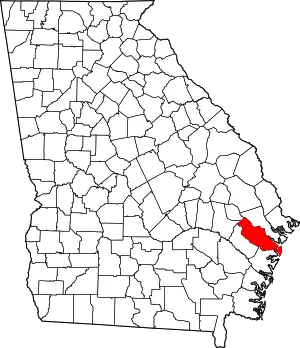 Location within the U.S. state of Georgia | |
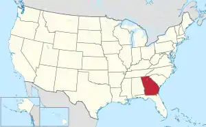 Georgia's location within the U.S. | |
| Coordinates: 31°48′N 81°28′W / 31.8°N 81.46°W | |
| Country | |
| State | |
| Founded | February 5, 1777 |
| Named for | Liberty |
| Seat | Hinesville |
| Largest city | Hinesville |
| Area | |
| • Total | 603 sq mi (1,560 km2) |
| • Land | 490 sq mi (1,300 km2) |
| • Water | 113 sq mi (290 km2) 18.7% |
| Population (2020) | |
| • Total | 65,256 |
| • Density | 133/sq mi (51/km2) |
| Time zone | UTC−5 (Eastern) |
| • Summer (DST) | UTC−4 (EDT) |
| Congressional district | 1st |
| Website | www |
Liberty County is a county in the U.S. state of Georgia. As of the 2020 census, the population is 65,256.[1] The county seat is Hinesville.[2]
Liberty County is part of the Hinesville, Georgia Metropolitan Statistical Area, which is also included in the Savannah-Hinesville-Statesboro, Georgia Combined Statistical Area.
History
Liberty County was established in 1777. It is named for the American ideal of liberty.[3] Sunbury was first designated the county seat in 1784. In 1797, the seat was transferred to Riceboro, and in 1837 it was transferred again to Hinesville.[4]
1922 lynching
On July 1, 1922, James Harvey and Joe Jordan, two African American men, were lynched by a mob of about 50 people in Liberty County during an escort by police from Jesup, Georgia to a jail in Savannah, Georgia. The event drew condemnation from both the local black community and from several prominent white citizens, with the preacher at Midway Methodist Church denouncing the acts and publishing a widely circulated letter condemning the Wayne County officials of being complicit in the murders. The incident prompted an investigation by the NAACP, and in total, 22 men were indicted, with four being convicted.[5]
Geography
According to the U.S. Census Bureau, the county has a total area of 603 square miles (1,560 km2), of which 490 square miles (1,300 km2) is land and 113 square miles (290 km2) (18.7%) is water.[6]
The eastern and southern portion of Liberty County is located in the Ogeechee Coastal sub-basin of the Ogeechee River basin. The northern and western portion of the county is located in the Canoochee River sub-basin of the Ogeechee River basin.[7]
Major highways
 Interstate 95
 U.S. Route 17
 U.S. Route 84
 State Route 25
 State Route 38
 State Route 38 Connector
 State Route 119
 State Route 144
 State Route 196
 State Route 405 (unsigned designation for I-95)
Adjacent counties
- Chatham County - northeast
- Bryan County - north
- McIntosh County - south
- Long County - west
- Evans County - northwest
- Tattnall County - northwest
Communities
Cities
- Allenhurst
- Flemington
- Gumbranch
- Hinesville (county seat)
- Midway
- Riceboro
- Walthourville
Census-designated place
Unincorporated communities
Demographics
| Census | Pop. | Note | %± |
|---|---|---|---|
| 1790 | 5,355 | — | |
| 1800 | 5,313 | −0.8% | |
| 1810 | 6,228 | 17.2% | |
| 1820 | 6,695 | 7.5% | |
| 1830 | 7,233 | 8.0% | |
| 1840 | 7,241 | 0.1% | |
| 1850 | 7,926 | 9.5% | |
| 1860 | 8,367 | 5.6% | |
| 1870 | 7,688 | −8.1% | |
| 1880 | 10,649 | 38.5% | |
| 1890 | 12,887 | 21.0% | |
| 1900 | 13,093 | 1.6% | |
| 1910 | 12,924 | −1.3% | |
| 1920 | 12,707 | −1.7% | |
| 1930 | 8,153 | −35.8% | |
| 1940 | 8,595 | 5.4% | |
| 1950 | 8,444 | −1.8% | |
| 1960 | 14,487 | 71.6% | |
| 1970 | 17,569 | 21.3% | |
| 1980 | 37,583 | 113.9% | |
| 1990 | 52,745 | 40.3% | |
| 2000 | 61,610 | 16.8% | |
| 2010 | 63,453 | 3.0% | |
| 2020 | 65,256 | 2.8% | |
| U.S. Decennial Census[8] 1790-1880[9]1890-1910[10] 1920-1930[11] 1930-1940[12] 1940-1950[13] 1960-1980[14] 1980-2000[15] 2010[16] | |||
| Race | Num. | Perc. |
|---|---|---|
| White (non-Hispanic) | 24,004 | 36.78% |
| Black or African American (non-Hispanic) | 27,309 | 41.85% |
| Native American | 225 | 0.34% |
| Asian | 1,325 | 2.03% |
| Pacific Islander | 437 | 0.67% |
| Other/Mixed | 4,170 | 6.39% |
| Hispanic or Latino | 7,786 | 11.93% |
As of the 2020 United States census, there were 65,256 people, 23,485 households, and 16,657 families residing in the county.
Education
Liberty County School District is the designated school district for grades K-12 for the county, except parts in Fort Stewart. Fort Stewart has the Department of Defense Education Activity (DoDEA) as its local school district,[18] for the elementary level.[19] Students at the secondary level on Fort Stewart attend public schools operated by county school districts.[20]
The Liberty district operates public schools, including the comprehensive high school Liberty County High School and the Bradwell Institute, as well as its educative middle schools Midway Middle School, Lewis Frasier Middle School, and Snelson-Golden Middle School.
They also provide a career academy, Liberty College & Career Academy (LCCA), for extra academics where students study for a profession they could seek out in the future.
In the media
The 2014 independent film, A Promise, was filmed in Liberty County.[21][22]
Politics
| Year | Republican | Democratic | Third party | |||
|---|---|---|---|---|---|---|
| No. | % | No. | % | No. | % | |
| 2020 | 7,959 | 37.20% | 13,104 | 61.25% | 331 | 1.55% |
| 2016 | 6,134 | 37.68% | 9,556 | 58.70% | 589 | 3.62% |
| 2012 | 5,565 | 34.36% | 10,457 | 64.57% | 173 | 1.07% |
| 2008 | 5,828 | 35.54% | 10,474 | 63.87% | 98 | 0.60% |
| 2004 | 6,131 | 47.86% | 6,619 | 51.67% | 59 | 0.46% |
| 2000 | 4,455 | 44.68% | 5,347 | 53.62% | 170 | 1.70% |
| 1996 | 3,042 | 37.42% | 4,462 | 54.89% | 625 | 7.69% |
| 1992 | 2,832 | 35.87% | 3,853 | 48.80% | 1,210 | 15.33% |
| 1988 | 3,100 | 51.24% | 2,906 | 48.03% | 44 | 0.73% |
| 1984 | 3,229 | 53.53% | 2,803 | 46.47% | 0 | 0.00% |
| 1980 | 1,507 | 32.18% | 3,099 | 66.18% | 77 | 1.64% |
| 1976 | 979 | 22.73% | 3,328 | 77.27% | 0 | 0.00% |
| 1972 | 2,337 | 65.76% | 1,217 | 34.24% | 0 | 0.00% |
| 1968 | 592 | 16.78% | 1,572 | 44.55% | 1,365 | 38.68% |
| 1964 | 1,458 | 39.73% | 2,212 | 60.27% | 0 | 0.00% |
| 1960 | 929 | 36.88% | 1,590 | 63.12% | 0 | 0.00% |
| 1956 | 967 | 52.02% | 892 | 47.98% | 0 | 0.00% |
| 1952 | 517 | 26.31% | 1,448 | 73.69% | 0 | 0.00% |
| 1948 | 121 | 9.98% | 820 | 67.66% | 271 | 22.36% |
| 1944 | 122 | 20.23% | 481 | 79.77% | 0 | 0.00% |
| 1940 | 102 | 20.00% | 407 | 79.80% | 1 | 0.20% |
| 1936 | 49 | 11.64% | 369 | 87.65% | 3 | 0.71% |
| 1932 | 18 | 5.84% | 289 | 93.83% | 1 | 0.32% |
| 1928 | 203 | 50.25% | 201 | 49.75% | 0 | 0.00% |
| 1924 | 39 | 9.38% | 334 | 80.29% | 43 | 10.34% |
| 1920 | 175 | 36.61% | 303 | 63.39% | 0 | 0.00% |
| 1916 | 26 | 6.95% | 245 | 65.51% | 103 | 27.54% |
| 1912 | 29 | 8.12% | 251 | 70.31% | 77 | 21.57% |
Gallery
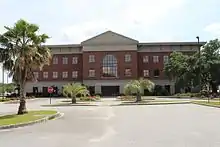
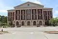 Liberty County Justice Center
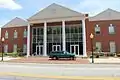 Liberty County Courthouse Annex
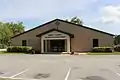 Liberty County Recreation Department
See also
References
- General
- ↑ "Census - Geography Profile: Liberty County, Georgia". United States Census Bureau. Retrieved December 27, 2022.
- ↑ "Find a County". National Association of Counties. Archived from the original on May 31, 2011. Retrieved June 7, 2011.
- ↑ Gannett, Henry (1905). The Origin of Certain Place Names in the United States. U.S. Government Printing Office. p. 186.
- ↑ Hellmann, Paul T. (May 13, 2013). Historical Gazetteer of the United States. Routledge. p. 233. ISBN 978-1135948597. Retrieved November 30, 2013.
- ↑ Harris, J. William (2001). Deep Souths: Delta, Piedmont, and Sea Island Society in the Age of Segregation. Johns Hopkins University Press. p. 288. ISBN 978-0-8018-6563-3 – via Google Books.
- ↑ "US Gazetteer files: 2010, 2000, and 1990". United States Census Bureau. February 12, 2011. Retrieved April 23, 2011.
- ↑ "Georgia Soil and Water Conservation Commission Interactive Mapping Experience". Georgia Soil and Water Conservation Commission. Retrieved November 22, 2015.
- ↑ "Decennial Census of Population and Housing by Decades". US Census Bureau.
- ↑ "1880 Census Population by Counties 1790-1800" (PDF). US Census Bureau. 1880.
- ↑ "1910 Census of Population - Georgia" (PDF). US Census Bureau. 1910.
- ↑ "1930 Census of Population - Georgia" (PDF). US Census Bureau. 1930.
- ↑ "1940 Census of Population - Georgia" (PDF). US Census Bureau. 1940.
- ↑ "1950 Census of Population - Georgia -" (PDF). US Census Bureau. 1950.
- ↑ "1980 Census of Population - Number of Inhabitants - Georgia" (PDF). US Census Bureau. 1980.
- ↑ "2000 Census of Population - Population and Housing Unit Counts - Georgia" (PDF). US Census Bureau. 2000.
- ↑ "State & County QuickFacts". United States Census Bureau. Archived from the original on June 7, 2011. Retrieved June 23, 2014.
- ↑ "Explore Census Data". data.census.gov. Retrieved December 14, 2021.
- ↑ "2020 CENSUS - SCHOOL DISTRICT REFERENCE MAP: Liberty County, GA" (PDF). U.S. Census Bureau. Archived (PDF) from the original on July 5, 2022. Retrieved July 5, 2022. - text list - "Fort Stewart School District" refers to the DoDEA schools.
- ↑ "Fort Stewart Schools". Department of Defense Education Activity. Retrieved July 5, 2022.
- ↑ "Fort Stewart Education". Military One Source. Retrieved July 5, 2022. - This is from a .mil website.
- ↑ "Film company sets premieres". www.bryancountynews.com. Archived from the original on April 6, 2016. Retrieved March 26, 2016.
- ↑ "Georgia hears about local film industry". coastalcourier.com. Archived from the original on April 9, 2016. Retrieved March 26, 2016.
- ↑ Leip, David. "Dave Leip's Atlas of U.S. Presidential Elections". uselectionatlas.org. Retrieved March 21, 2018.
- Specific
Places adjacent to Liberty County, Georgia | ||||||||||||||||
|---|---|---|---|---|---|---|---|---|---|---|---|---|---|---|---|---|
| ||||||||||||||||
Municipalities and communities of Liberty County, Georgia, United States | ||
|---|---|---|
| Cities | Map of Georgia highlighting Liberty County | |
| CDP | ||
| Unincorporated communities | ||
| Ghost towns | ||