Washington County | |
|---|---|
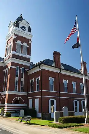 County courthouse | |
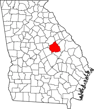 Location within the U.S. state of Georgia | |
 Georgia's location within the U.S. | |
| Coordinates: 32°58′N 82°47′W / 32.97°N 82.79°W | |
| Country | |
| State | |
| Founded | February 25, 1784 |
| Named for | George Washington |
| Seat | Sandersville |
| Largest city | Sandersville |
| Area | |
| • Total | 684 sq mi (1,770 km2) |
| • Land | 678 sq mi (1,760 km2) |
| • Water | 5.9 sq mi (15 km2) 0.9% |
| Population (2020) | |
| • Total | 19,988 |
| Time zone | UTC−5 (Eastern) |
| • Summer (DST) | UTC−4 (EDT) |
| Congressional district | 12th |
| Website | washingtoncountyga |
Washington County is a county located in the U.S. state of Georgia. As of the 2020 census, the population was 19,988.[1][2] The county seat is Sandersville.[3] The county was established on February 25, 1784. It was named for Revolutionary War general (and afterward President of the United States) George Washington.[4]
Geography
According to the U.S. Census Bureau, the county has a total area of 684 square miles (1,770 km2), of which 678 square miles (1,760 km2) is land and 5.9 square miles (15 km2) (0.9%) is water.[5]
The western portion of Washington County, west of a north-to-south line running through Sandersville, is located in the Lower Oconee River sub-basin of the Altamaha River basin. The northeastern portion of the county, north of Riddleville, is located in the Upper Ogeechee River sub-basin of the Ogeechee River basin, while the southeastern portion, centered on Harrison, is located in the Ohoopee River sub-basin of the Altamaha River basin.[6]
Major highways
Adjacent counties
- Glascock County (northeast)
- Jefferson County (east)
- Johnson County (south)
- Wilkinson County (southwest)
- Baldwin County (west)
- Hancock County (northwest)
Communities
Cities
- Davisboro
- Oconee
- Sandersville (county seat)
- Tennille
Towns
Census-designated places
Other unincorporated communities
Demographics
| Census | Pop. | Note | %± |
|---|---|---|---|
| 1790 | 4,552 | — | |
| 1800 | 10,300 | 126.3% | |
| 1810 | 9,940 | −3.5% | |
| 1820 | 10,627 | 6.9% | |
| 1830 | 9,820 | −7.6% | |
| 1840 | 10,565 | 7.6% | |
| 1850 | 11,766 | 11.4% | |
| 1860 | 12,698 | 7.9% | |
| 1870 | 15,842 | 24.8% | |
| 1880 | 21,964 | 38.6% | |
| 1890 | 25,237 | 14.9% | |
| 1900 | 28,227 | 11.8% | |
| 1910 | 28,174 | −0.2% | |
| 1920 | 28,147 | −0.1% | |
| 1930 | 25,030 | −11.1% | |
| 1940 | 24,230 | −3.2% | |
| 1950 | 21,012 | −13.3% | |
| 1960 | 18,903 | −10.0% | |
| 1970 | 17,480 | −7.5% | |
| 1980 | 18,842 | 7.8% | |
| 1990 | 19,112 | 1.4% | |
| 2000 | 21,176 | 10.8% | |
| 2010 | 21,187 | 0.1% | |
| 2020 | 19,988 | −5.7% | |
| U.S. Decennial Census[7] 1790-1880[8]1890-1910[9] 1920-1930[10] 1930-1940[11] 1940-1950[12] 1960-1980[13] 1980-2000[14] 2010[1] 2020[2] | |||
| Race | Num. | Perc. |
|---|---|---|
| White (non-Hispanic) | 8,412 | 42.09% |
| Black or African American (non-Hispanic) | 10,698 | 53.52% |
| Native American | 37 | 0.19% |
| Asian | 76 | 0.38% |
| Other/Mixed | 431 | 2.16% |
| Hispanic or Latino | 334 | 1.67% |
As of the 2020 United States census, there were 19,988 people, 7,503 households, and 5,315 families residing in the county.
Education
The county is served by the Washington County School District, which includes:[17]
- Ridge Road Elementary School
- T.J. Elder Middle School
- Washington County High School.
The county is also the location of one privately run school:
- Brentwood School
In popular culture
The 1933 short story "The People's Choice" by Erskine Caldwell is set in Washington County, where the story's protagonist is a popular local politician elected again and again as the county's tax assessor.
In 1992, the Pig Monument was erected in the county, near Oconee off of Georgia State Route 272. The monument commemorates a 1933 event where several residents of the county gathered together to help a local farmer rescue a pig that had fallen down a dry well.
The biography of one of the main characters (Grant Alexander) in the 2011 console game "X-Men: Destiny" states that they were born in Sandersville, Georgia.
Politics
Like most other majority-minority counties in the South, Washington County has primarily backed Democratic Party candidates for most of its history. Democratic margins of victory in presidential elections were far greater prior to 1964, but the county has only failed to back a Democratic presidential candidate five times in its history. However, no candidate of any party since Bill Clinton in 1996 has managed to win the county by a margin of 1,000 votes or greater.
| Year | Republican | Democratic | Third party | |||
|---|---|---|---|---|---|---|
| No. | % | No. | % | No. | % | |
| 2020 | 4,668 | 49.24% | 4,743 | 50.03% | 69 | 0.73% |
| 2016 | 4,149 | 48.90% | 4,200 | 49.50% | 136 | 1.60% |
| 2012 | 4,035 | 45.76% | 4,714 | 53.46% | 68 | 0.77% |
| 2008 | 4,216 | 47.49% | 4,607 | 51.89% | 55 | 0.62% |
| 2004 | 4,081 | 51.93% | 3,733 | 47.51% | 44 | 0.56% |
| 2000 | 3,162 | 47.26% | 3,476 | 51.95% | 53 | 0.79% |
| 1996 | 2,348 | 33.94% | 4,057 | 58.64% | 514 | 7.43% |
| 1992 | 2,384 | 35.45% | 3,508 | 52.16% | 833 | 12.39% |
| 1988 | 2,752 | 51.12% | 2,615 | 48.58% | 16 | 0.30% |
| 1984 | 2,887 | 48.76% | 3,034 | 51.24% | 0 | 0.00% |
| 1980 | 1,822 | 33.97% | 3,452 | 64.35% | 90 | 1.68% |
| 1976 | 1,657 | 30.01% | 3,865 | 69.99% | 0 | 0.00% |
| 1972 | 3,901 | 75.79% | 1,246 | 24.21% | 0 | 0.00% |
| 1968 | 1,247 | 26.43% | 1,443 | 30.58% | 2,029 | 43.00% |
| 1964 | 2,296 | 55.63% | 1,830 | 44.34% | 1 | 0.02% |
| 1960 | 956 | 32.30% | 2,004 | 67.70% | 0 | 0.00% |
| 1956 | 602 | 19.22% | 2,530 | 80.78% | 0 | 0.00% |
| 1952 | 795 | 25.03% | 2,381 | 74.97% | 0 | 0.00% |
| 1948 | 204 | 14.79% | 1,169 | 84.77% | 6 | 0.44% |
| 1944 | 351 | 24.29% | 1,094 | 75.71% | 0 | 0.00% |
| 1940 | 253 | 18.41% | 1,112 | 80.93% | 9 | 0.66% |
| 1936 | 149 | 10.34% | 1,286 | 89.24% | 6 | 0.42% |
| 1932 | 9 | 0.46% | 1,923 | 99.33% | 4 | 0.21% |
| 1928 | 472 | 29.24% | 1,142 | 70.76% | 0 | 0.00% |
| 1924 | 130 | 13.47% | 758 | 78.55% | 77 | 7.98% |
| 1920 | 118 | 9.42% | 1,134 | 90.58% | 0 | 0.00% |
| 1916 | 18 | 1.60% | 954 | 84.57% | 156 | 13.83% |
| 1912 | 28 | 2.51% | 920 | 82.51% | 167 | 14.98% |
See also
References
- 1 2 "State & County QuickFacts". United States Census Bureau. Retrieved June 27, 2014.
- 1 2 U.S. 2020 Census Bureau report, Washington County, Georgia
- ↑ "Find a County". National Association of Counties. Retrieved June 7, 2011.
- ↑ Krakow, Kenneth K. (1975). Georgia Place-Names: Their History and Origins (PDF). Macon, GA: Winship Press. p. 247. ISBN 0-915430-00-2. Archived (PDF) from the original on July 27, 2003.
- ↑ "US Gazetteer files: 2010, 2000, and 1990". United States Census Bureau. February 12, 2011. Retrieved April 23, 2011.
- ↑ "Georgia Soil and Water Conservation Commission Interactive Mapping Experience". Georgia Soil and Water Conservation Commission. Retrieved November 20, 2015.
- ↑ "Decennial Census of Population and Housing by Decades". US Census Bureau.
- ↑ "1880 Census Population by Counties 1790-1800" (PDF). US Census Bureau. 1880.
- ↑ "1910 Census of Population - Georgia" (PDF). US Census Bureau. 1910.
- ↑ "1930 Census of Population - Georgia" (PDF). US Census Bureau. 1930.
- ↑ "1940 Census of Population - Georgia" (PDF). US Census Bureau. 1940.
- ↑ "1950 Census of Population - Georgia -" (PDF). US Census Bureau. 1950.
- ↑ "1980 Census of Population - Number of Inhabitants - Georgia" (PDF). US Census Bureau. 1980.
- ↑ "2000 Census of Population - Population and Housing Unit Counts - Georgia" (PDF). US Census Bureau. 2000.
- ↑ "Explore Census Data". data.census.gov. Retrieved December 15, 2021.
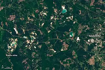
- ↑ Kaolin mines in Washington County, Georgia
- ↑ District, Washington County School. "Washington County Board of Education - Washington County Board of Education Listing". Retrieved May 26, 2009.
- ↑ Leip, David. "Dave Leip's Atlas of U.S. Presidential Elections". uselectionatlas.org. Retrieved March 24, 2018.
Further reading
- Ella Mitchell, History of Washington County. Atlanta, GA: Byrd Printing Company, 1924. —Reissued 1973.
External links
Places adjacent to Washington County, Georgia | ||||||||||||||||
|---|---|---|---|---|---|---|---|---|---|---|---|---|---|---|---|---|
| ||||||||||||||||
Municipalities and communities of Washington County, Georgia, United States | ||
|---|---|---|
| Cities | Map of Georgia highlighting Washington County | |
| Towns | ||
| CDP | ||
| Other unincorporated communities | ||