| Manajeba River | |
|---|---|
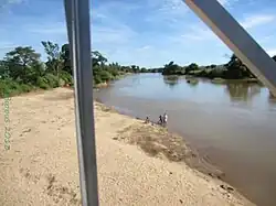 Manajeba River at Marivorahona | |
| Location | |
| Country | Madagascar |
| Region | Diana |
| City | Marivorahona |
| Physical characteristics | |
| Source | Tsaratanana Massif |
| • location | Diana |
| • elevation | 1,785 m (5,856 ft) |
| Mouth | |
• location | Indian Ocean |
• coordinates | 12°53′00″S 48°56′30″E / 12.88333°S 48.94167°E |
• elevation | 0 m (0 ft) |
| Length | 248 km (154 mi) |
| Basin size | 1,140 km2 (440 sq mi) |
| Discharge | |
| • location | Marivorahona- (1980-1983) |
| • average | 24.2 m3/s (850 cu ft/s)- (1980-1983) |
| • minimum | 0.497 m3/s (17.6 cu ft/s) |
| • maximum | 220 m3/s (7,800 cu ft/s) |
The Manajeba River is located in northern Madagascar. Its sources are situated near in the Tsaratanana Massif, it crosses the Route nationale 6 near Tanambao Marivorahona and flows into the Indian Ocean.
In January 2012 the bridge of 32 meters of the Route nationale 6 collapsed between Tanambao Marivorahona and the village of Marivorahona.[1]
References
This article is issued from Wikipedia. The text is licensed under Creative Commons - Attribution - Sharealike. Additional terms may apply for the media files.