Marcilhac-sur-Célé
| |
|---|---|
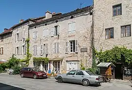 A street in Marcilhac-sur-Célé | |
.svg.png.webp) Coat of arms | |
Location of Marcilhac-sur-Célé | |
 Marcilhac-sur-Célé  Marcilhac-sur-Célé | |
| Coordinates: 44°33′15″N 1°46′18″E / 44.5542°N 1.7717°E | |
| Country | France |
| Region | Occitania |
| Department | Lot |
| Arrondissement | Figeac |
| Canton | Causse et Vallées |
| Intercommunality | CC Grand-Figeac |
| Government | |
| • Mayor (2020–2026) | Jean-Paul Mignat[1] |
| Area 1 | 27.35 km2 (10.56 sq mi) |
| Population | 193 |
| • Density | 7.1/km2 (18/sq mi) |
| Time zone | UTC+01:00 (CET) |
| • Summer (DST) | UTC+02:00 (CEST) |
| INSEE/Postal code | 46183 /46160 |
| Elevation | 140–391 m (459–1,283 ft) |
| 1 French Land Register data, which excludes lakes, ponds, glaciers > 1 km2 (0.386 sq mi or 247 acres) and river estuaries. | |
Marcilhac-sur-Célé (French pronunciation: [maʁsijak syʁ sele], lit. 'Marcilhac-on-Célé'; Occitan: Marcilhac), commonly referred to simply as Marcilhac, is a commune in the Lot department in the Occitania region in Southwestern France. It has many historic buildings, including the ruined 9th century Abbey of St Peter. As of 2019, it had a population of 203.
Gallery

Panorama of the ruined abbey
See also
References
- ↑ "Répertoire national des élus: les maires" (in French). data.gouv.fr, Plateforme ouverte des données publiques françaises. 4 May 2022.
- ↑ "Populations légales 2021". The National Institute of Statistics and Economic Studies. 28 December 2023.
Wikimedia Commons has media related to Marcilhac-sur-Célé.
This article is issued from Wikipedia. The text is licensed under Creative Commons - Attribution - Sharealike. Additional terms may apply for the media files.