Saint Géry-Vers | |
|---|---|
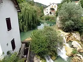 Mill and waterfall on the Vers river | |
Location of Saint Géry-Vers | |
 Saint Géry-Vers  Saint Géry-Vers | |
| Coordinates: 44°28′44″N 1°34′55″E / 44.479°N 1.582°E | |
| Country | France |
| Region | Occitania |
| Department | Lot |
| Arrondissement | Cahors |
| Canton | Causse et Vallées |
| Intercommunality | CA Grand Cahors |
| Area 1 | 31.52 km2 (12.17 sq mi) |
| Population | 909 |
| • Density | 29/km2 (75/sq mi) |
| Time zone | UTC+01:00 (CET) |
| • Summer (DST) | UTC+02:00 (CEST) |
| INSEE/Postal code | 46268 /46090, 46330 |
| 1 French Land Register data, which excludes lakes, ponds, glaciers > 1 km2 (0.386 sq mi or 247 acres) and river estuaries. | |
Saint Géry-Vers (Languedocien: Sent Juèli e Vèrn) is a commune in the department of Lot, southern France. The municipality was established on 1 January 2017 by merger of the former communes of Saint-Géry (the seat) and Vers.[2]
See also
References
Wikimedia Commons has media related to Saint Géry-Vers.
- ↑ "Populations légales 2021". The National Institute of Statistics and Economic Studies. 28 December 2023.
- ↑ Arrêté préfectoral 21 November 2016 (in French)
This article is issued from Wikipedia. The text is licensed under Creative Commons - Attribution - Sharealike. Additional terms may apply for the media files.