Saint-Jean-Lagineste | |
|---|---|
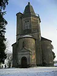 The chapel of Mont Saint-Joseph | |
Location of Saint-Jean-Lagineste | |
 Saint-Jean-Lagineste  Saint-Jean-Lagineste | |
| Coordinates: 44°49′27″N 1°51′42″E / 44.8242°N 1.8617°E | |
| Country | France |
| Region | Occitania |
| Department | Lot |
| Arrondissement | Figeac |
| Canton | Saint-Céré |
| Government | |
| • Mayor (2020–2026) | Monique Martignac[1] |
| Area 1 | 12.66 km2 (4.89 sq mi) |
| Population | 384 |
| • Density | 30/km2 (79/sq mi) |
| Time zone | UTC+01:00 (CET) |
| • Summer (DST) | UTC+02:00 (CEST) |
| INSEE/Postal code | 46339 /46400 |
| Elevation | 251–605 m (823–1,985 ft) (avg. 480 m or 1,570 ft) |
| 1 French Land Register data, which excludes lakes, ponds, glaciers > 1 km2 (0.386 sq mi or 247 acres) and river estuaries. | |
Saint-Jean-Lagineste (French pronunciation: [sɛ̃ ʒɑ̃ laʒinɛst]; Languedocien: La Ginèsta) is a commune in the Lot department in south-western France.[3]
See also
References
- ↑ "Répertoire national des élus: les maires" (in French). data.gouv.fr, Plateforme ouverte des données publiques françaises. 4 May 2022.
- ↑ "Populations légales 2021". The National Institute of Statistics and Economic Studies. 28 December 2023.
- ↑ INSEE commune file
Wikimedia Commons has media related to Saint-Jean-Lagineste.
This article is issued from Wikipedia. The text is licensed under Creative Commons - Attribution - Sharealike. Additional terms may apply for the media files.