Misato
美郷町 | |
|---|---|
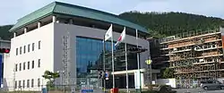
 Misato town hall | |
 Flag  Emblem | |
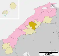
Location of Misato in Shimane Prefecture | |
 | |
 Misato Location in Japan | |
| Coordinates: 35°4′36″N 132°35′26″E / 35.07667°N 132.59056°E | |
| Country | Japan |
| Region | Chūgoku San'in |
| Prefecture | Shimane |
| District | Ōchi |
| Area | |
| • Total | 282.92 km2 (109.24 sq mi) |
| Population (July 31, 2023) | |
| • Total | 4,355 |
| • Density | 15/km2 (40/sq mi) |
| Time zone | UTC+09:00 (JST) |
| City hall address | 168 Kasubuchi, Misato-cho, Ochi-gun, Shimane-ken 699-4692 |
| Website | Official website |
| Symbols | |
| Flower | Rhododendron subg. Hymenanthes |
| Tree | Prunus mume |


Misato (美郷町, Misato-chō) is a town located in Ōchi District, Shimane Prefecture, Japan.[1][2] As of 31 July 2023, the town had an estimated population of 4,355 in 1844 households and a population density of 15 persons per km².[3] The total area of the town is 282.92 square kilometres (109.24 sq mi).
Geography
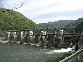
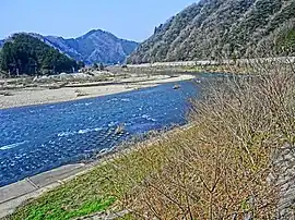
Misato is located in central Shimane, in the Chugoku Mountains bordered by Hiroshima Prefecture to the south. The Enokawa River runs through the town.
Climate
Misato has a humid subtropical climate (Köppen Cfa) characterized by warm summers and cool winters with light to no snowfall. The average annual temperature in Misato is 13.4 °C. The average annual rainfall is 1711 mm with September as the wettest month. The temperatures are highest on average in August, at around 25.0 °C, and lowest in January, at around 2.4 °C.[4]
Demographics
Per Japanese census data,[5] the population of Misato has been decreasing and is now only a third of what it was 50 years ago.
| Year | Pop. | ±% |
|---|---|---|
| 1970 | 15,460 | — |
| 1980 | 10,494 | −32.1% |
| 1990 | 8,838 | −15.8% |
| 2000 | 7,606 | −13.9% |
| 2010 | 6,624 | −12.9% |
| 2020 | 5,351 | −19.2% |
Neighboring municipalities
Shimane Prefecture
Hiroshima Prefecture
History
The area of Misato was part of ancient Iwami Province. During the Edo Period, the area was tenryō or direct territory of the Tokugawa shogunate, administered together with the Iwami Ginzan Silver Mine. Kasubuchi, the center of Misato Town, is located at the point where the Enokawa River, which flows northward in the Chugoku Mountains, bends and flows westward, and has prospered as a key point for boat transport on the Enogawa River. After the Meiji restoration, villages were established within Ōchi District, Shimane on April 1, 1889 with the creation of the modern municipalities system. The town of Misato was formed on October 1, 2004, from the merger of the village of Daiwa and the town of Ōchi.
Government
Misato has a mayor-council form of government with a directly elected mayor and a unicameral town council of 12 members. Misato, collectively with the towns of Kawamoto and Ōnan, contributes one member to the Shimane Prefectural Assembly. In terms of national politics, the town is part of the Shimane 2nd district of the lower house of the Diet of Japan.
Economy
Misato is a very rural area, with an economy based on agriculture and forestry.
Education
Misato has two public elementary school and two public junior high schools operated by the town government. The town does not have a high school
Transportation
Railway
Following the closure of the JR West Sankō Line on April 1, 2018, Misato no longer has any passenger railway service. The nearest train station is Gōtsu Station on the JR West San'in Main Line.
- Take - Onbara - Iwami-Yanaze - Akatsuka - Kasubuchi - Hamahara - Sawadani - Ushio - Iwami-Matsubara - Iwami Tsuga
Highways
References
- ↑ "島根県美郷町の町長選挙 現職の嘉戸隆さんが無投票で再選 |FNNプライムオンライン". FNNプライムオンライン. Retrieved 2022-10-22.
- ↑ "「都神楽団」島根・美郷町で長い年月かけ発展させた舞…石見神楽を上演 島根県出雲市(BSS山陰放送)". Yahoo!ニュース (in Japanese). Retrieved 2022-10-22.
- ↑ "Misato Town official statistics" (in Japanese). Japan.
- ↑ Misato climate: Average Temperature, weather by month
- ↑ "Shimane (Japan): Prefecture, Cities, Towns and Villages - Population Statistics, Charts and Map". www.citypopulation.de.
External links
 Media related to Misato, Shimane at Wikimedia Commons
- Misato official website (in Japanese)