Modrá Hůrka | |
|---|---|
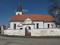 Church of the Assumption of the Virgin Mary | |
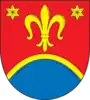 Coat of arms | |
 Modrá Hůrka Location in the Czech Republic | |
| Coordinates: 49°10′48″N 14°31′32″E / 49.18000°N 14.52556°E | |
| Country | |
| Region | South Bohemian |
| District | České Budějovice |
| First mentioned | 1354 |
| Area | |
| • Total | 3.96 km2 (1.53 sq mi) |
| Elevation | 513 m (1,683 ft) |
| Population (2023-01-01)[1] | |
| • Total | 101 |
| • Density | 26/km2 (66/sq mi) |
| Time zone | UTC+1 (CET) |
| • Summer (DST) | UTC+2 (CEST) |
| Postal code | 375 01 |
| Website | www |
Modrá Hůrka is a municipality and village in České Budějovice District in the South Bohemian Region of the Czech Republic. It has about 100 inhabitants.
Modrá Hůrka lies approximately 24 kilometres (15 mi) north of České Budějovice and 101 km (63 mi) south of Prague.
Administrative parts
The village of Pořežánky is an administrative part of Modrá Hůrka.
Notable people
- Eleonora Ehrenbergová (1832–1912), operatic soprano
References
Wikimedia Commons has media related to Modrá Hůrka.
This article is issued from Wikipedia. The text is licensed under Creative Commons - Attribution - Sharealike. Additional terms may apply for the media files.