Piana | |
|---|---|
 | |
 Coat of arms | |
Location of Piana | |
 Piana 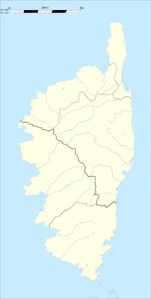 Piana | |
| Coordinates: 42°14′24″N 8°38′13″E / 42.24°N 8.6369°E | |
| Country | France |
| Region | Corsica |
| Department | Corse-du-Sud |
| Arrondissement | Ajaccio |
| Canton | Sevi-Sorru-Cinarca |
| Government | |
| • Mayor (2020–2026) | Pascaline Castellani[1] |
| Area 1 | 62.63 km2 (24.18 sq mi) |
| Population | 463 |
| • Density | 7.4/km2 (19/sq mi) |
| Time zone | UTC+01:00 (CET) |
| • Summer (DST) | UTC+02:00 (CEST) |
| INSEE/Postal code | 2A212 /20115 |
| Elevation | 0–1,332 m (0–4,370 ft) (avg. 450 m or 1,480 ft) |
| 1 French Land Register data, which excludes lakes, ponds, glaciers > 1 km2 (0.386 sq mi or 247 acres) and river estuaries. | |
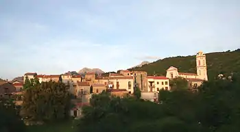
Piana (French pronunciation: [pjana]) is a commune in the Corse-du-Sud department of France on the island of Corsica.
Population
| Year | Pop. | ±% |
|---|---|---|
| 1962 | 499 | — |
| 1968 | 517 | +3.6% |
| 1975 | 513 | −0.8% |
| 1982 | 511 | −0.4% |
| 1990 | 500 | −2.2% |
| 1999 | 428 | −14.4% |
| 2008 | 444 | +3.7% |
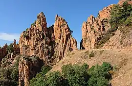
Calanques de Piana
See also
- Communes of the Corse-du-Sud department
- Calanques de Piana, UNESCO World Heritage Site
- Torra di Turghju
References
- ↑ "Répertoire national des élus: les maires". data.gouv.fr, Plateforme ouverte des données publiques françaises (in French). 2 December 2020.
- ↑ "Populations légales 2021". The National Institute of Statistics and Economic Studies. 28 December 2023.
Wikimedia Commons has media related to Piana.
This article is issued from Wikipedia. The text is licensed under Creative Commons - Attribution - Sharealike. Additional terms may apply for the media files.