Montfort | |
|---|---|
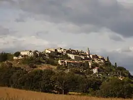 A general view of the village of Montfort | |
 Coat of arms | |
Location of Montfort | |
 Montfort 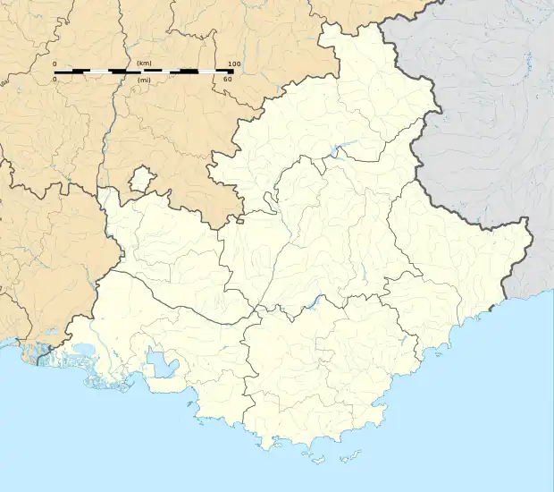 Montfort | |
| Coordinates: 44°03′52″N 5°58′24″E / 44.0644°N 5.9733°E | |
| Country | France |
| Region | Provence-Alpes-Côte d'Azur |
| Department | Alpes-de-Haute-Provence |
| Arrondissement | Forcalquier |
| Canton | Château-Arnoux-Saint-Auban |
| Government | |
| • Mayor (2020–2026) | Yannick Gendron[1] |
| Area 1 | 12.08 km2 (4.66 sq mi) |
| Population | 329 |
| • Density | 27/km2 (71/sq mi) |
| Time zone | UTC+01:00 (CET) |
| • Summer (DST) | UTC+02:00 (CEST) |
| INSEE/Postal code | 04127 /04600 |
| Elevation | 395–860 m (1,296–2,822 ft) (avg. 500 m or 1,600 ft) |
| 1 French Land Register data, which excludes lakes, ponds, glaciers > 1 km2 (0.386 sq mi or 247 acres) and river estuaries. | |
Montfort (French pronunciation: [mɔ̃fɔʁ] ⓘ; Occitan: Montfòrt) is a commune in the Alpes-de-Haute-Provence department in southeastern France.
Population
| Year | Pop. | ±% p.a. |
|---|---|---|
| 1968 | 142 | — |
| 1975 | 240 | +7.79% |
| 1982 | 259 | +1.09% |
| 1990 | 382 | +4.98% |
| 1999 | 385 | +0.09% |
| 2009 | 383 | −0.05% |
| 2014 | 356 | −1.45% |
| 2020 | 325 | −1.51% |
| Source: INSEE[3] | ||
See also
References
- ↑ "Répertoire national des élus: les maires". data.gouv.fr, Plateforme ouverte des données publiques françaises (in French). 2 December 2020.
- ↑ "Populations légales 2021". The National Institute of Statistics and Economic Studies. 28 December 2023.
- ↑ Population en historique depuis 1968, INSEE
Wikimedia Commons has media related to Montfort, Alpes-de-Haute-Provence.
This article is issued from Wikipedia. The text is licensed under Creative Commons - Attribution - Sharealike. Additional terms may apply for the media files.