| Old Norse name | Vemunðarey |
|---|---|
| Meaning of name | Vémunðr's island (personal name) |
| Location | |
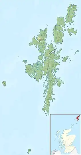
 Vementry Vementry shown within Shetland | |
| OS grid reference | HU296606 |
| Coordinates | 60°19′46″N 1°27′47″W / 60.3294°N 1.463022°W |
| Physical geography | |
| Island group | Shetland |
| Area | 370 hectares (1.43 sq mi) |
| Area rank | 80 [1] |
| Highest elevation | 90 metres (295 ft) Muckle Ward |
| Administration | |
| Sovereign state | United Kingdom |
| Country | Scotland |
| Council area | Shetland Islands |
| Demographics | |
| Population | 0[2] |
| References | [3][4][5] |

Vementry (Old Norse: "Vemunðarey"[5]) is an uninhabited Scottish island in Shetland on the north side of the West Mainland, lying south of Muckle Roe.
Description and history
The island is known for its well-preserved chambered cairn. The well-preserved remains of a Neolithic heel-shaped cairn about 10 metres (33 feet) in diameter and rising to over 1.5 metres (4.9 feet) in height.[6]
Also on the island are two 6-inch QF Mk I First World War gun emplacements which overlook the narrow entrance into the former naval anchorage of Busta Voe on Swarbacks Head, a cliff standing around 49 metres (161 feet) above sea level. These guns were removed from HMS Gibraltar, an Edgar-class cruiser which was acting as a depot ship for 10th Cruiser Squadron. They were manned by a mixed crew of RN sailors and Royal Marines. The guns are mounted en barbette on concrete platforms with a 0.45-metre-high (18-inch) concrete parapet and gun shield to provide protection against incoming fire. There are two ammunition lockers built into the parapet of each gun platform, and each platform is linked to a separate main magazine by a trench. A simple stone-and-concrete fire control pillbox also exists on the site. The guns were abandoned in situ after the end of the First World War and were never used after this time.
Mainland and island
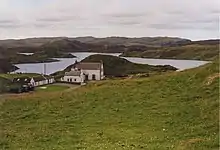
Vementry is also the name of a small farm on Mainland, Shetland, immediately south of the island. For this reason, it is sometimes referred to as the "Isle of Vementry". There is no ferry service to the island, although the shepherd on the mainland farm occasionally makes the short trip to work with stock on the island.
The Isle of Vementry is separated from the mainland Vementry by a narrow channel or "sound", consisting of Uyea Sound to the east and Cribba Sound to the west. Cribba Sound is famed for the quality of mussels produced at the mussel farms located there.
References
- ↑ Area and population ranks: there are c. 300 islands over 20 ha in extent and 93 permanently inhabited islands were listed in the 2011 census.
- ↑ National Records of Scotland (15 August 2013). "Appendix 2: Population and households on Scotland's Inhabited Islands" (PDF). Statistical Bulletin: 2011 Census: First Results on Population and Household Estimates for Scotland Release 1C (Part Two) (PDF) (Report). SG/2013/126. Retrieved 14 August 2020.
- ↑ Haswell-Smith, Hamish. (2004) The Scottish Islands. Edinburgh. Canongate.
- ↑ Ordnance Survey. OS Maps Online (Map). 1:25,000. Leisure.
- 1 2 Anderson, Joseph (Ed.) (1893) Orkneyinga Saga. Translated by Jón A. Hjaltalin & Gilbert Goudie. Edinburgh. James Thin and Mercat Press (1990 reprint). ISBN 0-901824-25-9
- ↑ "Vementry". RCAHMS. Retrieved 27 September 2013.
60°19′46″N 1°27′47″W / 60.32944°N 1.46306°W
