Municipality of Kostanjevica na Krki
Občina Kostanjevica na Krki | |
|---|---|
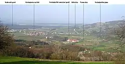
 View of the Municipality of Kostanjevica na Krki from the village of Male Vodenice | |
 Coat of arms | |
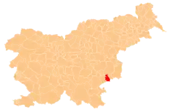
 Location of the Municipality of Kostanjevica na Krki in Slovenia | |
| Coordinates: 45°51′N 15°25′E / 45.850°N 15.417°E | |
| Country | |
| Elevation | 150.4 m (493.4 ft) |
| Population (2002)[1] | |
| • Total | 751 |
| Time zone | UTC+01 (CET) |
| • Summer (DST) | UTC+02 (CEST) |
| Postal code | 8311 |
| Website | www |
| Source: Statistical Office of the Republic of Slovenia, census of 2002. | |
The Municipality of Kostanjevica na Krki (pronounced [kɔˈstaːnjɛʋitsa na ˈkəɾki] ⓘ; Slovene: Občina Kostanjevica na Krki) is a municipality in the traditional Lower Carniola region of southern Slovenia. The seat of the municipality is the town of Kostanjevica na Krki. It is part of the Lower Sava Statistical Region.[2] It is located in the northern foothills of the Gorjanci Hills and extends to the border with Croatia.
Settlements
In addition to the municipal seat of Kostanjevica na Krki, the municipality also includes the following settlements:
References
External links
 Media related to Municipality of Kostanjevica na Krki at Wikimedia Commons
- Municipality of Kostanjevica na Krki on Geopedia
- Kostanjevica municipal website (in Slovene)
This article is issued from Wikipedia. The text is licensed under Creative Commons - Attribution - Sharealike. Additional terms may apply for the media files.