 | ||||
|---|---|---|---|---|
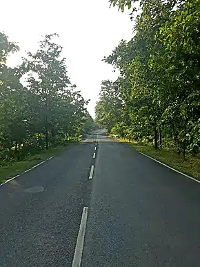
 NH133 near Godda | ||||
| Route information | ||||
| Auxiliary route of NH 33 | ||||
| Length | 134 km (83 mi) | |||
| Existed | 26 September 2012 [1]–present | |||
| Major junctions | ||||
| North end | Pirpainti | |||
| South end | Choupa More | |||
| Location | ||||
| Country | India | |||
| States | Bihar, Jharkhand | |||
| Highway system | ||||
| ||||
National Highway 133, commonly called NH 133 is a national highway in India.[1][2] It is a spur road of National Highway 33.[3] NH-133 traverses the states of Jharkhand and Bihar in India. This national highway is 134 km (83 mi) long.[2][4]
Route
- Bihar
Junction with NH-33 (near Pirpainti) - Jharkhand border.[1][2]
- Jharkhand
Junctions
Gallery
 Roundabout near NH133 towards Godda, Jharkhand
 Cross roads at Hansdiha
See also
References
- 1 2 3 4 5 "New highways notification dated September, 2012" (PDF). The Gazette of India - Ministry of Road Transport and Highways. Archived from the original (PDF) on 4 August 2018. Retrieved 4 August 2018.
- 1 2 3 "State-wise length of National Highways (NH) in India as on 30.06.2017". Ministry of Road Transport and Highways. Retrieved 4 August 2018.
- ↑ "New Numbering of National Highways notification - Government of India" (PDF). The Gazette of India. Archived from the original (PDF) on 4 May 2018. Retrieved 4 August 2018.
- ↑ "Status of National highways in Jharkhand - July 2016". Press Information Bureau - Government Of India. Archived from the original on 13 December 2017. Retrieved 4 August 2018.
- ↑ "National Highways passing through Bihar" (PDF). Road construction department - Government of Bihar. Archived from the original (PDF) on 17 April 2018. Retrieved 4 August 2018.
External links
Wikimedia Commons has media related to NH 133 (India).
This article is issued from Wikipedia. The text is licensed under Creative Commons - Attribution - Sharealike. Additional terms may apply for the media files.


