 | ||||
|---|---|---|---|---|
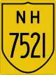
| Route information | ||||
| Auxiliary route of NH 52 | ||||
| Length | 406 km (252 mi) | |||
| Major junctions | ||||
| West end | Kopargaon | |||
| East end | Dhanoda | |||
| Location | ||||
| Country | India | |||
| States | Maharashtra | |||
| Highway system | ||||
| ||||
National Highway 752I, commonly referred to as NH 752I is a national highway in India.[1][2] It is a spur road of National Highway 52.[3] NH-752I traverses the state Maharashtra in India.
Route
NH 752I
Kopargaon, Vaijapur, Lasur, Aurangabad, Jalana Watur, Mantha, Jintur, Aunda Nagnath, Basmat, Ardhapur, Tamsa, Himayatnagar, Dhanki Phulsawangi, Mahur, Dhanoda.[1][2][4]
Junctions
See also
References
- 1 2 3 "New national highways notifications dated Jan, 2017" (PDF). The Gazette of India - Ministry of Road Transport and Highways. Retrieved 19 August 2018.
- 1 2 "State-wise length of National Highways (NH) in India as on 30.06.2017". Ministry of Road Transport and Highways. Retrieved 19 August 2018.
- ↑ "New Numbering of National Highways notification - Government of India" (PDF). The Gazette of India. Retrieved 19 August 2018.
- 1 2 "National highways substitution notification" (PDF). The Gazette of India - Ministry of Road Transport and Highways. Retrieved 19 August 2018.
External links


This article is issued from Wikipedia. The text is licensed under Creative Commons - Attribution - Sharealike. Additional terms may apply for the media files.