 | ||||
|---|---|---|---|---|
Map of the National Highway in red | ||||
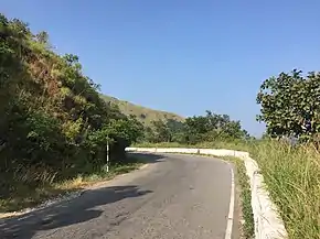 NH 73 crossing Charmadi Ghat | ||||
| Route information | ||||
| Length | 317 km (197 mi) | |||
| Major junctions | ||||
| West end | Mangaluru | |||
| East end | Tumakuru | |||
| Location | ||||
| Country | India | |||
| States | Karnataka | |||
| Highway system | ||||
| ||||
National Highway 73 (NH 73) is a National Highway in India. This highway runs in the Indian state of Karnataka. It starts from sea port city of Mangaluru ( Mangalore) and ends at Tumakuru.[1] Even though named as national highway the road is narrow and prone to landslips and falling of trees in Charmady ghat section of Western ghats.[2] This highway was previously part of national highways 48, 234 and 206 but subsequent to rationalisation of national highway numbers of India by Gazette notification on 5 March 2010 it was changed to National Highway 73.[3]
Route
.jpg.webp)
The national highway 73 ( NH-73) connects towns of Mangaluru, Bantwal Beltangady, Ujire, Charmadi, Kottigehara, Mudigere, Belur, Halebeedu, Javagal, Banavara, Arasikere, Tiptur, Kibbanahalli, Nittur, Gubbi and Tumakuru in the state of Karnataka.[4]
Junctions
See also
References
- ↑ "New Numbering of National Highways notification - Government of India" (PDF). The Gazette of India. Retrieved 10 April 2019.
- ↑ "Charmadi Ghat Road to remain closed till September 14". Times of India. 15 August 2019. Retrieved 6 November 2019.
- ↑ "Rationalisation of Numbering Systems of National Highways" (PDF). New Delhi: Department of Road Transport and Highways. Archived from the original (PDF) on 4 December 2018. Retrieved 10 April 2019.
- ↑ "State-wise length of National Highways (NH) in India". Ministry of Road Transport and Highways. Retrieved 10 April 2019.
External links


Secondary routes of National Highway 73 | ||
|---|---|---|
| ||
| Secondary Routes of NH 73 | ||