Route 161 | ||||
|---|---|---|---|---|
 | ||||
| Route information | ||||
| Maintained by Transports Québec | ||||
| Length | 185.1 km[1] (115.0 mi) Pre-2006: 205.5 km (127.7 mi) | |||
| History | ||||
| Major junctions | ||||
| South end | ||||
| North end | ||||
| Location | ||||
| Country | Canada | |||
| Province | Quebec | |||
| Major cities | Victoriaville | |||
| Highway system | ||||
| ||||

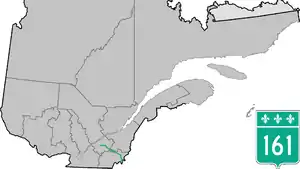
Route 161 is a north/south highway south of the St. Lawrence River in Quebec, Canada. Its current northern terminus is at Autoroute 20 in Sainte-Eulalie, just east of the junction of Autoroute 55, while its southern terminus is at the border of Maine in the USA, where it continues as Maine State Route 27. Previously the highway continued to Route 155 in Saint-Célestin, but that section was decommissioned in 2006 when Autoroute 55 was completed.[2]
On July 6, 2013, the route was severed at Lac-Mégantic, Quebec by an oil train derailment. Ministry of Transport consultants began surveying a site for a new bridge across the Chaudière River in August 2013.[3]
Municipalities along Route 161
Major intersections
| RCM | Location | km[1] | mi | Destinations | Notes |
|---|---|---|---|---|---|
| Le Granit | Saint-Augustin-de-Woburn | 0.0 | 0.0 | Continuation into Maine | |
| Canada–United States border at Coburn Gore–Woburn Border Crossing | |||||
| 4.4 | 2.7 | ||||
| 8.1 | 5.0 | ||||
| Lac-Mégantic | 31.3 | 19.4 | Rue Frontenac | Former R-161 north | |
| 33.3 | 20.7 | ||||
| 35.5 | 22.1 | Rue Villeneuve | Interchange | ||
| Nantes | 41.3 | 25.7 | Roundabout; former R-161 south; south end of R-263 concurrency | ||
| 43.2 | 26.8 | North end of R-263 concurrency | |||
| 49.6 | 30.8 | ||||
| Stornoway | 63.6 | 39.5 | |||
| Le Haut-Saint-François | Weedon | 89.5 | 55.6 | South end of R-112 concurrency | |
| Les Appalaches | Beaulac-Garthby | 96.9 | 60.2 | North end of R-112 concurrency | |
| Arthabaska | Ham-Nord | 115.5 | 71.8 | South end of R-216 concurrency | |
| 120.9 | 75.1 | North end of R-216 concurrency | |||
| Saint-Christophe-d'Arthabaska | 150.9 | 93.8 | South end of R-116 concurrency | ||
| Victoriaville | 152.7 | 94.9 | Boulevard des Bois-Francs – Centre-Ville | ||
| 154.4 | 95.9 | Boulevard Jutras | |||
| 157.2 | 97.7 | R-122 eastern terminus; north end of R-116 concurrency; south end of R-122 concurrency | |||
| 161.8 | 100.5 | ||||
| 164.7 | 102.3 | North end of R-122 concurrency | |||
| Saint-Valère | 176.7 | 109.8 | |||
| Nicolet-Yamaska | Sainte-Eulalie | 185.1 | 115.0 | R-161 northern terminus; A-20 exit 210 | |
| Saint-Célestin | 204.7 | 127.2 | Former south end of R-266 concurrency | ||
| 205.5 | 127.7 | Former A-55 southern terminus (Trois-Rivières section); former R-161 northern terminus[2] | |||
1.000 mi = 1.609 km; 1.000 km = 0.621 mi
| |||||
See also
References
- 1 2 Google (June 20, 2023). "Quebec Route 161" (Map). Google Maps. Google. Retrieved June 20, 2023.
- 1 2 Government du Québec (2001). "Enlargement Southern Québec" (Map). Québec Official Road Map. 1:505,000. Les Publications du Québec. §§ H-27,I-28.
- ↑ ICI.Radio-Canada.ca, Zone Aucun thème sélectionné- (2013-08-17). "Lac-Mégantic : début des travaux de relocalisation des commerces | Radio-Canada.ca". Radio-Canada (in Canadian French). Retrieved 2023-11-21.
External links
- Interactive Provincial Route Map (Transports Québec) (in French)
- Route 161 on Google Maps
This article is issued from Wikipedia. The text is licensed under Creative Commons - Attribution - Sharealike. Additional terms may apply for the media files.