Répcelak | |
|---|---|
 Flag  Coat of arms | |
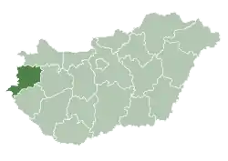
 Répcelak Location of Répcelak | |
| Coordinates: 47°25′16″N 17°01′06″E / 47.42105°N 17.01836°E | |
| Country | Hungary |
| County | Vas |
| Area | |
| • Total | 13.82 km2 (5.34 sq mi) |
| Population (2015) | |
| • Total | 2,625 |
| • Density | 190/km2 (490/sq mi) |
| Time zone | UTC+1 (CET) |
| • Summer (DST) | UTC+2 (CEST) |
| Postal code | 9653 |
| Area code | 95 |
| Motorways | M86 |
| Distance from Budapest | 185 km (115 mi) East |
Twin towns — sister cities
Répcelak is twinned with:
 Lehnice, Slovakia
External links
- Street map (in Hungarian)

This article is issued from Wikipedia. The text is licensed under Creative Commons - Attribution - Sharealike. Additional terms may apply for the media files.