 | ||||
|---|---|---|---|---|
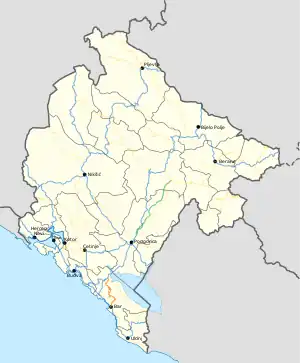
| Regionalni put R-28 | ||||
 | ||||
| Route information | ||||
| Length | 37.8 km (23.5 mi) | |||
| Major junctions | ||||
| South end | ||||
| North end | ||||
| Location | ||||
| Country | Montenegro | |||
| Municipalities | Bar | |||
| Highway system | ||||
| ||||
R-28 regional road (Montenegrin: Regionalni put R-28) is a Montenegrin roadway.[1]
History
R-28 regional road was first built as a Bar - Virpazar railroad. Construction on this railway started in 1905. In 1959, all operations on this railway stopped, after which it was adapted for road transport.[2]
In November 2019, the Government of Montenegro published bylaw on categorisation of state roads.[1] With new categorisation, R-28 regional road was created from municipal road.
Major intersections
| Municipality | Location | km | mi | Destinations | Notes |
|---|---|---|---|---|---|
| Bar | Bar | 0.0 | 0.0 | ||
| Virpazar | 37.8 | 23.5 | |||
| 1.000 mi = 1.609 km; 1.000 km = 0.621 mi | |||||
References
- 1 2 "Odluka o kategorizaciji državnih puteva" [Decision on categorisation of state roads]. www.sluzbenilist.me (in Montenegrin). Official Gazette of Montenegro. 25 November 2019. Retrieved 5 March 2020.
- ↑ "Virpazar - Bar" (PDF). www.zcg-prevoz.me (in Montenegrin). Željeznički prevoz Crne Gore. Retrieved 22 March 2020.
| Motorways | ||
|---|---|---|
| Highways | ||
| Regional roads | ||
| ||
This article is issued from Wikipedia. The text is licensed under Creative Commons - Attribution - Sharealike. Additional terms may apply for the media files.