 | ||||
|---|---|---|---|---|
| Regionalni put R-8 | ||||
 | ||||
| Route information | ||||
| Length | 50.9 km (31.6 mi) | |||
| Major junctions | ||||
| East end | ||||
| West end | ||||
| Location | ||||
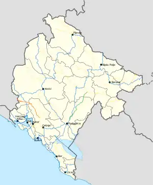
| Country | Montenegro | |||
| Municipalities | Cetinje, Nikšić | |||
| Highway system | ||||
| ||||
R-8 regional road (Montenegrin: Regionalni put R-8) (previously known as R-23 regional road) is a Montenegrin roadway.[1]
History
In January 2016, the Ministry of Transport and Maritime Affairs published bylaw on categorisation of state roads.[1] With this bylaw R-23 regional road was renamed as R-8 regional road.
Major intersections
| Municipality | Location | km | mi | Destinations | Notes |
|---|---|---|---|---|---|
| Cetinje | Resna | 0.0 | 0.0 | ||
| Nikšić | Grahovo | 33.8 | 21.0 | ||
| Nudo, Nikšić | 50.9 | 31.6 | Border crossing with Bosnia and Herzegovina | ||
| 1.000 mi = 1.609 km; 1.000 km = 0.621 mi | |||||
References
- 1 2 "Pravilnik o kategorizaciji državnih puteva" [Regulation on categorisation of state roads]. www.sluzbenilist.me (in Montenegrin). Official Gazette of Montenegro. 5 January 2016. Retrieved 18 June 2017.
| Motorways | ||
|---|---|---|
| Highways | ||
| Regional roads | ||
| ||
This article is issued from Wikipedia. The text is licensed under Creative Commons - Attribution - Sharealike. Additional terms may apply for the media files.