Raškovice | |
|---|---|
.JPG.webp) Chapel of the Virgin Mary | |
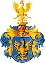
 Flag  Coat of arms | |
 Raškovice Location in the Czech Republic | |
| Coordinates: 49°37′11″N 18°28′22″E / 49.61972°N 18.47278°E | |
| Country | |
| Region | Moravian-Silesian |
| District | Frýdek-Místek |
| First mentioned | 1305 |
| Area | |
| • Total | 8.63 km2 (3.33 sq mi) |
| Elevation | 395 m (1,296 ft) |
| Population (2023-01-01)[1] | |
| • Total | 2,025 |
| • Density | 230/km2 (610/sq mi) |
| Time zone | UTC+1 (CET) |
| • Summer (DST) | UTC+2 (CEST) |
| Postal code | 739 04 |
| Website | www |
Raškovice (Polish: Raszkowice) is a municipality and village in Frýdek-Místek District in the Moravian-Silesian Region of the Czech Republic. It has about 2,000 inhabitants.
Geography
Raškovice lies in the historical region of Cieszyn Silesia. The municipality is located in the Moravian-Silesian Foothills on the left bank of the Morávka River.
History
The first written mention of Raškovice is from 1305 as Holzmul settlement and Rudgeri villa. The village under its current name was first mentioned in 1573.[2]
After World War I and fall of Austria-Hungary it became a part of Czechoslovakia. In March 1939 it became a part of Protectorate of Bohemia and Moravia. After World War II it was restored to Czechoslovakia.
References
- ↑ "Population of Municipalities – 1 January 2023". Czech Statistical Office. 2023-05-23.
- ↑ "Vznik obce" (in Czech). Obec Raškovice. Retrieved 2022-03-02.
External links
Wikimedia Commons has media related to Raškovice.
This article is issued from Wikipedia. The text is licensed under Creative Commons - Attribution - Sharealike. Additional terms may apply for the media files.

