42°46′N 110°51′W / 42.767°N 110.850°W The Salt River Range is a mountain range in western Wyoming. The 56 mile long range[1] forms the eastern boundary of Star Valley as well as the western boundary of the Greys River valley. The highest point is Mount Fitzpatrick at 10,907 feet (3,324 m).[1]
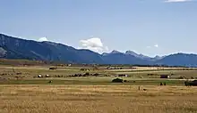
Salt River Range with Haystack Peak in the distance
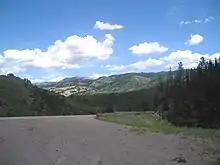
Salt River Range in Wyoming
See also
Notes
- 1 2 "Salt River Range". peakbagger.com. Retrieved November 29, 2008.
This article is issued from Wikipedia. The text is licensed under Creative Commons - Attribution - Sharealike. Additional terms may apply for the media files.