Santa Rosa | |
|---|---|
| Municipality of Santa Rosa | |
 | |
 Flag  Seal | |
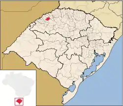
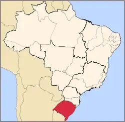
 Location in Rio Grande do Sul | |
| Country | |
| State | |
| Region | South |
| Founded | 10 August 1931 |
| Government | |
| • Mayor | Anderson Mantei (PP) |
| Area | |
| • Total | 489.798 km2 (189.112 sq mi) |
| Elevation | 277 m (909 ft) |
| Population (2022)[1] | |
| • Total | 77,519 |
| • Density | 160/km2 (410/sq mi) |
| Demonym | santa-rosense |
| Time zone | UTC−3 (BRT) |
| Postal Code | 98780-001 to 98798-970 |
| HDI (2010) | 0.769 – high[2] |
| Website | santarosa |
Santa Rosa is a municipality in the Brazilian state of Rio Grande do Sul, located at latitude 27º52'15" and longitude 54º28'53" at a height of 277 meters above sea level. It has an area of 488.42 km2. Its estimated population is 73,575 (2020).[3] It is known as the "National Cradle of Soybeans".
History
Santa Rosa was created as a colony of European immigrants in 1915, mainly Italians, Germans and Russians. The German dialect traditionally spoken in the region is Riograndenser Hunsrückisch.
Notable residents
- Xuxa, popular Brazilian celebrity
- Cláudio Taffarel, Brazilian World Cup winning goalkeeper
- Luís Carlos Winck, football player
- Deonise, handball player, World Champion
Transportation
The city is served by Luís Alberto Lehr Airport.
Events
- Soybean National Fair (Fenasoja)
- South American Nativist Music Festival (Musicanto)
- State Meeting of horticulture (Hortigranjeiros)
- Dance in Santa Rosa Festival
- Festival of Ethnic Groups
- Piggy in Roller Feast
- Cruzeiro Neighborhood Community Fair (EXPOCruzeiro)
- Oktoberfest
- Student Song Festival (Canto Livre)
- Santa Rosa Shows Gramado
Economy
In agriculture, the city has the largest dairy basin in Rio Grande do Sul, providing, together with pig farming, raw materials for agro-industries. The city has a large production of soybeans, yerba mate, as well as vegetables and colonial products. In industry, the city has a strong metal-mechanical hub, manufacturing parts, machines and agricultural implements, with companies such as AGCO and John Deere. Around 66% of Brazilian harvesters are produced in the city.[4]
References
- ↑ "Censo Demográfico IBGE 2022" (PDF). Instituto Brasileiro de Geografia e Estatística (IBGE). 25 December 2022. Retrieved 31 December 2022.
- ↑ "Archived copy" (PDF). United Nations Development Programme (UNDP). Archived from the original (PDF) on July 8, 2014. Retrieved August 1, 2013.
{{cite web}}: CS1 maint: archived copy as title (link) - ↑ IBGE 2020
- ↑ Economy of Santa Rosa
External links
- Santa Rosa city hall page (Portuguese)
- Santa Rosa detailed Street Map
- Jornal Noroeste - news from the city and region
27°52′01″S 54°28′01″W / 27.867°S 54.467°W
