| Saumalkol | |
|---|---|
| Саумалкөл | |
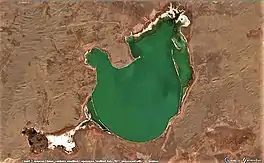
 Sentinel-2 image of the lake | |
 Saumalkol | |
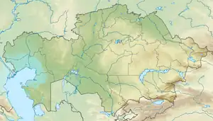
| Location | Kazakh Uplands |
| Coordinates | 49°49′N 75°00′E / 49.817°N 75.000°E |
| Type | endorheic |
| Primary outflows | none |
| Catchment area | 307 square kilometers (119 sq mi) |
| Basin countries | Kazakhstan |
| Max. length | 6 kilometers (3.7 mi) |
| Max. width | 4.7 kilometers (2.9 mi) |
| Surface area | 20.2 square kilometers (7.8 sq mi) |
| Average depth | 1.5 meters (4 ft 11 in) |
| Residence time | UTC+6 |
| Surface elevation | 632 meters (2,073 ft) |
Saumalkol (Kazakh: Саумалкөл; Russian: Саумалколь) is a salt lake in northwestern Karkaraly District, Karaganda Region, Kazakhstan.[1][2]
The lake is located 50 kilometers (31 mi) to the northwest of Karkaraly city. The nearest inhabited place is Saumalkol railway station 5 kilometers (3.1 mi) to the southwest.[3] The lake is a 2,171 hectares (5,360 acres) Important Bird Area part of the Korgalzhyn Nature Reserve.[4][5]
Geography
Saumalkol is an endorheic lake in the central Kazakh Uplands. It lies at the feet of the southern slopes of the Ayr Mountains. Located 8 kilometers (5.0 mi) to the west of the western end of lake Karasor, it is the second largest of the lakes of a vast depression. The southern shore of the lake is flat, but the northern is steep with up to 15 meters (49 ft) high cliffs. The lake is shallow, with a maximum depth of 3 meters (9.8 ft) to 5 meters (16 ft). Its water is salty and hard and the bottom of the lake is muddy, having a smell of hydrogen sulfide.[6]
The lake is fed mainly by snow and groundwater. Two rivers having their sources in the Ayr Mountains, a 23 kilometers (14 mi) long and a 10 kilometers (6.2 mi) long one, flow from the northwest into the lake. They dry up in the summer. There is a small peninsula in the northern shore.[3][6]
Flora and fauna
Steppe vegetation grows in the area surrounding the lake. There is a narrow belt of reeds along the shoreline. There are no fish in the waters. The endangered white-headed duck[7] and the common goldeneye are among the migratory bird species found in Saumalkol.[6][4]
See also
References
- ↑ "M-43 Topographic Chart (in Russian)". Retrieved 18 October 2022.
- ↑ Lakes in the Central Kazakhstan
- 1 2 Google Earth
- 1 2 Saumalkol Lake - IBA Criteria - BirdLife Data Zone
- ↑ Saving birds by UNDP Eurasia
- 1 2 3 Saumalkol Lake - BirdLife Data Zone
- ↑ Record numbers of Endangered White-headed ducks counted in Kazakhstan