There are thirteen scheduled monuments in Birmingham, England.
In the United Kingdom, a scheduled monument is a "nationally important" archaeological site or historic building that has been given protection against unauthorised change by being placed on a list (or "schedule") by the Secretary of State for Culture, Media and Sport; English Heritage takes the leading role in identifying such sites.[1] Monuments are defined in the Ancient Monuments and Archaeological Areas Act 1979 and the National Heritage Act 1983. Scheduled monuments—sometimes referred to as scheduled ancient monuments—can also be protected through listed building procedures, and English Heritage considers listed building status to be a better way of protecting buildings and standing structures.[1] A scheduled monument that is later determined to "no longer merit scheduling" can be descheduled.[2]
List
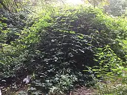
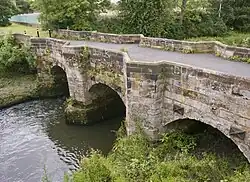
Birmingham's scheduled monuments are:[3]


Notes
- ↑ The date given is the date used by Historic England as significant for the initial building or that of an important part in the structure's description.
- ↑ Sometimes known as OSGB36, the grid reference is based on the British national grid reference system used by the Ordnance Survey.
- ↑ The "List Entry Number" is a unique number assigned to each listed building and scheduled monument by Historic England.
References
- 1 2 "The Schedule of Monuments". Pastscape. English Heritage. Retrieved 14 October 2012.
- ↑ "Scheduled Monuments". English Heritage. Retrieved 15 October 2012.
- ↑ "Birmingham's Scheduled Ancient Monuments". Birmingham City Council. Retrieved 24 August 2014.
- ↑ Historic England. "Details from listed building database (1020541)". National Heritage List for England. Retrieved 24 August 2014.
- ↑ Historic England. "Details from listed building database (1017810)". National Heritage List for England. Retrieved 24 August 2014.
- ↑ Historic England. "Details from listed building database (1005885)". National Heritage List for England. Retrieved 24 August 2014.
- ↑ Historic England. "Details from listed building database (1005909)". National Heritage List for England. Retrieved 24 August 2014.
- ↑ Historic England. "Details from listed building database (1016437)". National Heritage List for England. Retrieved 24 August 2014.
- ↑ Historic England. "Details from listed building database (1020542)". National Heritage List for England. Retrieved 24 August 2014.
- ↑ Historic England. "Details from listed building database (1017648)". National Heritage List for England. Retrieved 24 August 2014.
- ↑ Historic England. "Details from listed building database (1002980)". National Heritage List for England. Retrieved 24 August 2014.
- ↑ Historic England. "Details from listed building database (1020420)". National Heritage List for England. Retrieved 24 August 2014.
- ↑ Historic England. "Details from listed building database (1005905)". National Heritage List for England. Retrieved 24 August 2014.
- ↑ Historic England. "Details from listed building database (1020540)". National Heritage List for England. Retrieved 24 August 2014.