Telfordville | |
|---|---|
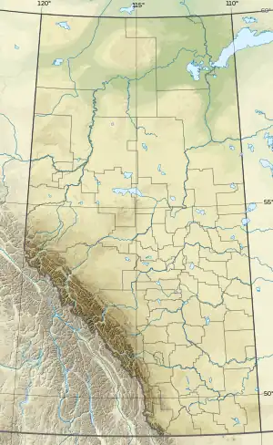 Telfordville Location of Telfordville  Telfordville Telfordville (Canada) | |
| Coordinates: 53°16′24″N 114°10′14″W / 53.27333°N 114.17056°W | |
| Country | Canada |
| Province | Alberta |
| Region | Edmonton Metropolitan Region |
| Census division | 11 |
| Municipal district | Leduc County |
| Government | |
| • Type | Unincorporated |
| • Governing body | Leduc County Council |
| Area (2021)[1] | |
| • Land | 0.4 km2 (0.2 sq mi) |
| Population (2021)[1] | |
| • Total | 35 |
| • Density | 86.7/km2 (225/sq mi) |
| Time zone | UTC−07:00 (MST) |
| • Summer (DST) | UTC−06:00 (MDT) |
| Area code(s) | 780, 587, 825 |
Telfordville is a hamlet in central Alberta, Canada within Leduc County.[2] It is located just off Highway 622, approximately 41 kilometres (25 mi) west of Leduc. It is named for Robert Telford, former Leduc mayor and member of the Legislative Assembly of Alberta.[3]
Demographics
In the 2021 Census of Population conducted by Statistics Canada, Telfordville had a population of 35 living in 13 of its 16 total private dwellings, a change of 75% from its 2016 population of 20. With a land area of 0.4 km2 (0.15 sq mi), it had a population density of 87.5/km2 (226.6/sq mi) in 2021.[1]
As a designated place in the 2016 Census of Population conducted by Statistics Canada, Telfordville had a population of 20 living in 11 of its 15 total private dwellings, compared to its 2011 population of 0. With a land area of 0.41 km2 (0.16 sq mi), it had a population density of 48.8/km2 (126.3/sq mi) in 2016.[4]
See also
References
- 1 2 3 "Population and dwelling counts: Canada and designated places". Statistics Canada. February 9, 2022. Retrieved February 10, 2022.
- ↑ "Specialized and Rural Municipalities and Their Communities" (PDF). Alberta Municipal Affairs. January 12, 2022. Retrieved January 21, 2022.
- ↑ Hulgaard, William Joseph; White, John Wesley (2002). Honoured in places: remembered mounties across Canada. Victoria, British Columbia: Heritage Group Distribution. p. 169. ISBN 1-894384-39-3.
- ↑ "Population and dwelling counts, for Canada, provinces and territories, and designated places, 2016 and 2011 censuses – 100% data (Alberta)". Statistics Canada. February 8, 2017. Retrieved February 13, 2017.