Ternat | |
|---|---|
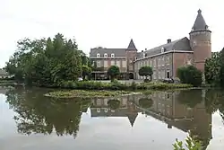 Kruikenburg Castle, Ternat | |
 Flag  Coat of arms | |
Location of Ternat | |
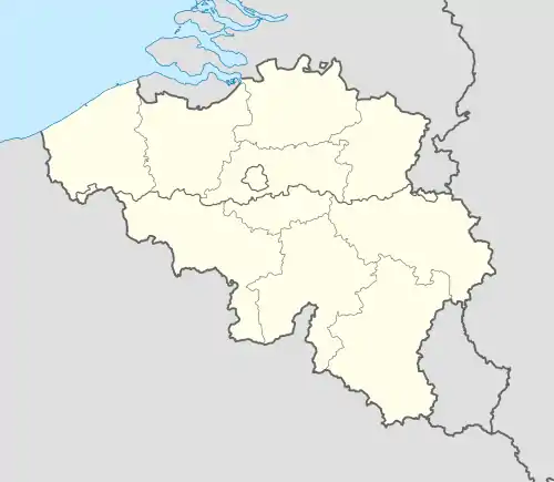 Ternat Location in Belgium
Location of Ternat in Flemish Brabant 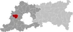 | |
| Coordinates: 50°52′N 04°11′E / 50.867°N 4.183°E | |
| Country | |
| Community | Flemish Community |
| Region | Flemish Region |
| Province | Flemish Brabant |
| Arrondissement | Halle-Vilvoorde |
| Government | |
| • Mayor | Michel Vanderhasselt (CD&V en Volks) |
| • Governing party/ies | CD&V en Volks, Voor Ternat |
| Area | |
| • Total | 24.71 km2 (9.54 sq mi) |
| Population (2018-01-01)[1] | |
| • Total | 15,481 |
| • Density | 630/km2 (1,600/sq mi) |
| Postal codes | 1740-1742 |
| NIS code | 23086 |
| Area codes | 02, 053 |
| Website | www.ternat.be |
Ternat (Dutch pronunciation: [tɛrˈnɑt]; also French: Ternath) is a municipality located in the Belgian province of Flemish Brabant. The municipality comprises the villages of Sint-Katherina-Lombeek, Ternat proper and Wambeek. It is also situated in the Pajottenland. On January 1, 2018 Ternat had a total population of 15.481. The total area is 24.48 km² which gives a population density of 597 inhabitants per km².
The village of Ternat is the site of a medieval sandstone church and the 12th-century Kruikenburg Castle, extensively remodelled in the 17th century.[2] The local authority offices are housed in an 18th-century mansion.[3]
Notable people
- Everard t'Serclaes (c.1320–1388)
References
- ↑ "Wettelijke Bevolking per gemeente op 1 januari 2018". Statbel. Retrieved 9 March 2019.
- ↑ Kasteel Kruikenburg, website Toerisme Vlaams Brabant, accessed 23 October 2015.
- ↑ Kasteel De Mot, Flemish Heritage Register. Accessed 23 October 2015.
External links
 Media related to Ternat at Wikimedia Commons

This article is issued from Wikipedia. The text is licensed under Creative Commons - Attribution - Sharealike. Additional terms may apply for the media files.