Tignale
| |
|---|---|
| Comune di Tignale | |
 | |
|
Coat of arms | |
Location of Tignale | |
 Tignale Location of Tignale in Italy 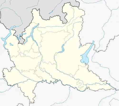 Tignale Tignale (Lombardy) | |
| Coordinates: 45°44′N 10°43′E / 45.733°N 10.717°E | |
| Country | Italy |
| Region | Lombardy |
| Province | Brescia (BS) |
| Frazioni | Aer, Gardola (communal seat), Oldesio, Olzano Piovere, Prabione |
| Government | |
| • Mayor | Franco Negri |
| Area | |
| • Total | 48 km2 (19 sq mi) |
| Elevation | 555 m (1,821 ft) |
| Population (30 June 2011)[2] | |
| • Total | 1,317 |
| • Density | 27/km2 (71/sq mi) |
| Demonym | Tignalesi |
| Time zone | UTC+1 (CET) |
| • Summer (DST) | UTC+2 (CEST) |
| Postal code | 25080 |
| Dialing code | 0365 |
| ISTAT code | 017185 |
| Saint day | 8 September |
| Website | Official website |
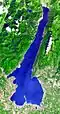
Tignale (locally Tignàl) is a comune in the province of Brescia, in Lombardy, northern Italy. It is an international tourist center on the Lake Garda.
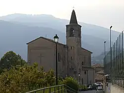
It is formed by a series of villages located from up to 1600 m of altitude to the shores of the lake (none of them is called Tignale). The communal seat is at Gardola. Sights include the sanctuary of Montecastello, on a cliff commanding the Lake Garda, and remains of World War I fortifications.
References
- ↑ "Superficie di Comuni Province e Regioni italiane al 9 ottobre 2011". Italian National Institute of Statistics. Retrieved 16 March 2019.
- ↑ Population from ISTAT
Wikimedia Commons has media related to Tignale.
| Settlements |
|  |
|---|---|---|
| Islands |
| |
| Rivers | ||
| Wines | ||
| People | ||
This article is issued from Wikipedia. The text is licensed under Creative Commons - Attribution - Sharealike. Additional terms may apply for the media files.