Ula | |
|---|---|
District and municipality | |
 | |
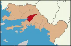
 Map showing Ula District in Muğla Province | |
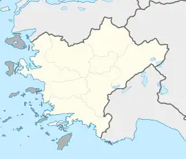
 Ula Location in Turkey  Ula Ula (Turkey Aegean) | |
| Coordinates: 37°06′13″N 28°24′53″E / 37.10361°N 28.41472°E | |
| Country | Turkey |
| Province | Muğla |
| Government | |
| • Mayor | Özay Türkler (AKP) |
| Area | 479 km2 (185 sq mi) |
| Population (2022)[1] | 26,613 |
| • Density | 56/km2 (140/sq mi) |
| Time zone | TRT (UTC+3) |
| Postal code | 48640 |
| Area code | 0252 |
| Website | www |

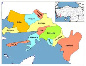
Ula is a municipality and district of Muğla Province, Turkey.[2] Its area is 479 km2,[3] and its population is 26,613 (2022).[1] Its name reflects the ancient town of Ula in ancient Caria, whose site is conjectured to be nearby.[4]
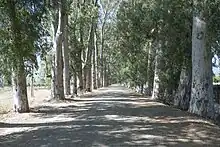
The town of Ula is situated at a distance of only 14 km (9 mi) from the province seat of Muğla, a mile after a bifurcation on the road to Marmaris. It is notable for its old houses in the Turkish style and the vast forest region that extends to the south along the country road called Çiçekli after the town. The history of the inhabitants and the town, situated in ancient Caria, can be traced at least as far back as the dynasty of Menteşe.
The towns of Akyaka and Gökova, situated at a close distance to each other at the tip of the Gulf of Gökova, are both rising centers of international tourism.
Composition
There are 25 neighbourhoods in Ula District:[5]
See also
References
- 1 2 "Address-based population registration system (ADNKS) results dated 31 December 2022, Favorite Reports" (XLS). TÜİK. Retrieved 19 September 2023.
- ↑ Büyükşehir İlçe Belediyesi, Turkey Civil Administration Departments Inventory. Retrieved 19 September 2023.
- ↑ "İl ve İlçe Yüz ölçümleri". General Directorate of Mapping. Retrieved 19 September 2023.
- ↑ Lund University. Digital Atlas of the Roman Empire.
- ↑ Mahalle, Turkey Civil Administration Departments Inventory. Retrieved 19 September 2023.
- Peter Benedict (1974). Ula : An Anatolian Town. Brill Publishers. ISBN 90-04-03882-5.
External links
