Val-de-Meuse | |
|---|---|
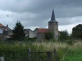 The church of Lénizeul in Val-de-Meuse | |
 Coat of arms | |
Location of Val-de-Meuse | |
 Val-de-Meuse  Val-de-Meuse | |
| Coordinates: 48°00′01″N 5°29′48″E / 48.0003°N 5.4967°E | |
| Country | France |
| Region | Grand Est |
| Department | Haute-Marne |
| Arrondissement | Langres |
| Canton | Bourbonne-les-Bains |
| Intercommunality | Grand Langres |
| Government | |
| • Mayor (2020–2026) | Romary Didier[1] |
| Area 1 | 92.56 km2 (35.74 sq mi) |
| Population | 1,813 |
| • Density | 20/km2 (51/sq mi) |
| Time zone | UTC+01:00 (CET) |
| • Summer (DST) | UTC+02:00 (CEST) |
| INSEE/Postal code | 52332 /52140 |
| 1 French Land Register data, which excludes lakes, ponds, glaciers > 1 km2 (0.386 sq mi or 247 acres) and river estuaries. | |
Val-de-Meuse (French pronunciation: [val də møz]) is a commune in the Haute-Marne department in north-eastern France.
Val-de-Meuse was created in 1972 by the merger of the former communes of Avrecourt, Épinant, Lécourt, Maulain, Montigny-le-Roi (main area of the new commune), Provenchères-sur-Meuse, Ravennefontaines, Récourt and Saulxures and in 1974 Lénizeul. In 2012 Avrecourt and Saulxures became independent communes again.
See also
References
- ↑ "Répertoire national des élus: les maires". data.gouv.fr, Plateforme ouverte des données publiques françaises (in French). 2 December 2020.
- ↑ "Populations légales 2021". The National Institute of Statistics and Economic Studies. 28 December 2023.
Wikimedia Commons has media related to Val-de-Meuse.
This article is issued from Wikipedia. The text is licensed under Creative Commons - Attribution - Sharealike. Additional terms may apply for the media files.