Alando | |
|---|---|
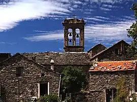 Former convent | |
Location of Alando | |
 Alando 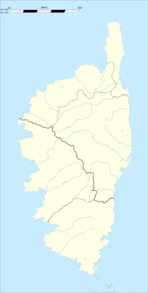 Alando | |
| Coordinates: 42°18′26″N 9°17′28″E / 42.3072°N 9.2911°E | |
| Country | France |
| Region | Corsica |
| Department | Haute-Corse |
| Arrondissement | Corte |
| Canton | Golo-Morosaglia |
| Intercommunality | Pasquale Paoli |
| Government | |
| • Mayor (2020–2026) | Guy Mamelli[1] |
| Area 1 | 3.05 km2 (1.18 sq mi) |
| Population | 26 |
| • Density | 8.5/km2 (22/sq mi) |
| Time zone | UTC+01:00 (CET) |
| • Summer (DST) | UTC+02:00 (CEST) |
| INSEE/Postal code | 2B005 /20250 |
| Elevation | 480–1,040 m (1,570–3,410 ft) (avg. 660 m or 2,170 ft) |
| 1 French Land Register data, which excludes lakes, ponds, glaciers > 1 km2 (0.386 sq mi or 247 acres) and river estuaries. | |
Alando is a commune in the Haute-Corse department of France on the island of Corsica.
Population
| Year | Pop. | ±% p.a. |
|---|---|---|
| 1968 | 51 | — |
| 1975 | 42 | −2.74% |
| 1982 | 38 | −1.42% |
| 1990 | 15 | −10.97% |
| 1999 | 23 | +4.86% |
| 2007 | 26 | +1.54% |
| 2012 | 29 | +2.21% |
| 2017 | 35 | +3.83% |
| Source: INSEE[3] | ||
See also
References
- ↑ "Répertoire national des élus: les maires". data.gouv.fr, Plateforme ouverte des données publiques françaises (in French). 2 December 2020.
- ↑ "Populations légales 2021". The National Institute of Statistics and Economic Studies. 28 December 2023.
- ↑ Population en historique depuis 1968, INSEE
Wikimedia Commons has media related to Alando.
This article is issued from Wikipedia. The text is licensed under Creative Commons - Attribution - Sharealike. Additional terms may apply for the media files.