Arkong Bato | |
|---|---|
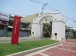 Stone arch and linear park | |
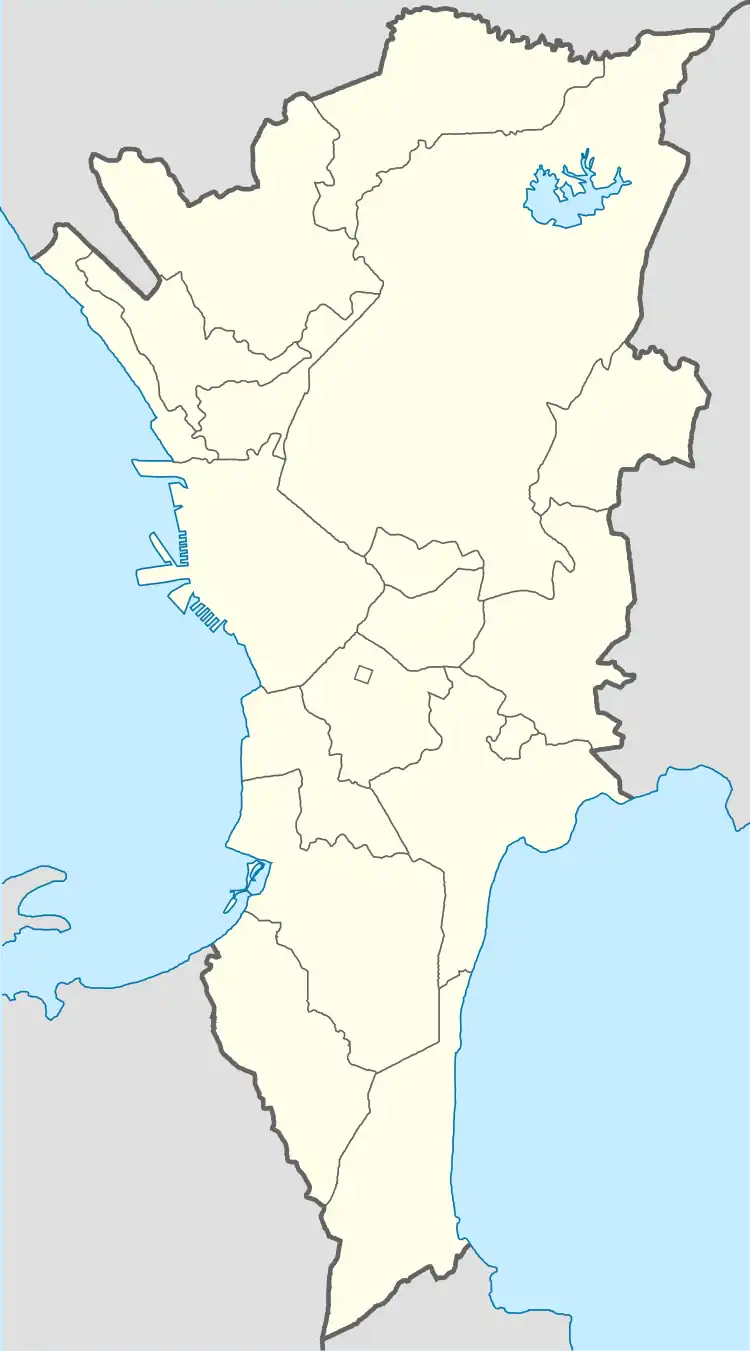 Arkong Bato Location of Arkong Bato in Metro Manila | |
| Coordinates: 14°41′53″N 120°57′3″E / 14.69806°N 120.95083°E | |
| Country | |
| Region | National Capital Region |
| City | Valenzuela |
| Congressional districts | Part of the 1st district of Valenzuela |
| Government | |
| • Barangay Chairman | AJ Feliciano |
| Area | |
| • Total | 0.34 km2 (0.13 sq mi) |
| Population (2020) | |
| • Total | 11,358 |
| • Density | 33,000/km2 (87,000/sq mi) |
| ZIP code | 1444 |
| Area code | 2 |
Arkong Bato (lit. 'Stone Arch') is one of the constituent barangays in the city of Valenzuela, Metro Manila, Philippines.
Arkong Bato is a historical barangay named after the famous stone arch landmark on Marcelo H. Del Pilar Street that demarcates its boundary with Barangays Panghulo and Santolan in Malabon.[1] The notable stone arch was built by the Americans in 1910, originally as a boundary marker between Rizal and Bulacan provinces, which Malabon and Valenzuela were once part of, respectively.[2]
Festivals
Residents celebrate the Sta. Cruz fiesta every 3rd Sunday of May.[2]
Landmarks
Some of the landmarks of the barangay include the Arkong Bato Chapel and the statue of Delfin Belilia Navarese at Navarette Street.[2]
References
- ↑ "Valenzuela and its Stone Arch". The Urban Roamer. May 28, 2014. Retrieved January 31, 2023.
- 1 2 3 "Arkong Bato". City Government of Valenzuela. Retrieved January 31, 2023.
External links
 Media related to Arkong Bato at Wikimedia Commons
- Valenzuela, Philippines official site
| Topics |  | |
|---|---|---|
| Government | ||
| Districts | ||
| Places |
| |
This article is issued from Wikipedia. The text is licensed under Creative Commons - Attribution - Sharealike. Additional terms may apply for the media files.