Azay-sur-Indre | |
|---|---|
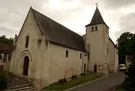 The church in Azay-sur-Indre | |
.svg.png.webp) Coat of arms | |
Location of Azay-sur-Indre | |
 Azay-sur-Indre  Azay-sur-Indre | |
| Coordinates: 47°12′35″N 0°56′46″E / 47.2097°N 0.9461°E | |
| Country | France |
| Region | Centre-Val de Loire |
| Department | Indre-et-Loire |
| Arrondissement | Loches |
| Canton | Loches |
| Intercommunality | CC Loches Sud Touraine |
| Government | |
| • Mayor (2020–2026) | Jean-Jacques Meunier[1] |
| Area 1 | 13.89 km2 (5.36 sq mi) |
| Population | 354 |
| • Density | 25/km2 (66/sq mi) |
| Time zone | UTC+01:00 (CET) |
| • Summer (DST) | UTC+02:00 (CEST) |
| INSEE/Postal code | 37016 /37310 |
| Elevation | 61–106 m (200–348 ft) |
| 1 French Land Register data, which excludes lakes, ponds, glaciers > 1 km2 (0.386 sq mi or 247 acres) and river estuaries. | |
Azay-sur-Indre (French pronunciation: [azɛ syʁ ɛ̃dʁ] ⓘ, literally Azay on Indre) is a commune in the Indre-et-Loire department in central France.
Geography
The Indrois flows west through the eastern part of the commune, then flows into the Indre.
The village lies in the middle of the commune, on the left bank of the Indre, which flows northwest through the middle of the commune.
Population
| Year | Pop. | ±% p.a. |
|---|---|---|
| 1968 | 307 | — |
| 1975 | 272 | −1.71% |
| 1982 | 289 | +0.87% |
| 1990 | 309 | +0.84% |
| 1999 | 355 | +1.55% |
| 2007 | 379 | +0.82% |
| 2012 | 389 | +0.52% |
| 2017 | 385 | −0.21% |
| Source: INSEE[3] | ||
See also
References
- ↑ "Répertoire national des élus: les maires". data.gouv.fr, Plateforme ouverte des données publiques françaises (in French). 2 December 2020.
- ↑ "Populations légales 2021". The National Institute of Statistics and Economic Studies. 28 December 2023.
- ↑ Population en historique depuis 1968, INSEE
Wikimedia Commons has media related to Azay-sur-Indre.
This article is issued from Wikipedia. The text is licensed under Creative Commons - Attribution - Sharealike. Additional terms may apply for the media files.