Céré-la-Ronde | |
|---|---|
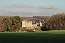 Chateau of Monpoupon | |
.svg.png.webp) Coat of arms | |
Location of Céré-la-Ronde | |
 Céré-la-Ronde  Céré-la-Ronde | |
| Coordinates: 47°15′41″N 1°11′27″E / 47.2614°N 1.1908°E | |
| Country | France |
| Region | Centre-Val de Loire |
| Department | Indre-et-Loire |
| Arrondissement | Loches |
| Canton | Bléré |
| Government | |
| • Mayor (2020–2026) | Jacques Duvivier[1] |
| Area 1 | 49.2 km2 (19.0 sq mi) |
| Population | 420 |
| • Density | 8.5/km2 (22/sq mi) |
| Time zone | UTC+01:00 (CET) |
| • Summer (DST) | UTC+02:00 (CEST) |
| INSEE/Postal code | 37046 /37460 |
| Elevation | 84–186 m (276–610 ft) |
| 1 French Land Register data, which excludes lakes, ponds, glaciers > 1 km2 (0.386 sq mi or 247 acres) and river estuaries. | |
Céré-la-Ronde (French pronunciation: [seʁe la ʁɔ̃d] ⓘ) is a commune in the Indre-et-Loire department, central France.
Population
| Year | Pop. | ±% p.a. |
|---|---|---|
| 1968 | 636 | — |
| 1975 | 567 | −1.63% |
| 1982 | 477 | −2.44% |
| 1990 | 435 | −1.15% |
| 1999 | 437 | +0.05% |
| 2007 | 420 | −0.49% |
| 2012 | 454 | +1.57% |
| 2017 | 459 | +0.22% |
| Source: INSEE[3] | ||
See also
References
- ↑ "Répertoire national des élus: les maires" (in French). data.gouv.fr, Plateforme ouverte des données publiques françaises. 13 September 2022.
- ↑ "Populations légales 2021". The National Institute of Statistics and Economic Studies. 28 December 2023.
- ↑ Population en historique depuis 1968, INSEE
Wikimedia Commons has media related to Céré-la-Ronde.
This article is issued from Wikipedia. The text is licensed under Creative Commons - Attribution - Sharealike. Additional terms may apply for the media files.