Saint-Benoît-la-Forêt | |
|---|---|
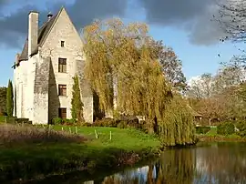 Former Benedictine abbey | |
Location of Saint-Benoît-la-Forêt | |
 Saint-Benoît-la-Forêt  Saint-Benoît-la-Forêt | |
| Coordinates: 47°13′18″N 0°19′23″E / 47.2217°N 0.3231°E | |
| Country | France |
| Region | Centre-Val de Loire |
| Department | Indre-et-Loire |
| Arrondissement | Chinon |
| Canton | Chinon |
| Intercommunality | Chinon, Vienne et Loire |
| Government | |
| • Mayor (2020–2026) | Didier Guilbault[1] |
| Area 1 | 35.25 km2 (13.61 sq mi) |
| Population | 846 |
| • Density | 24/km2 (62/sq mi) |
| Time zone | UTC+01:00 (CET) |
| • Summer (DST) | UTC+02:00 (CEST) |
| INSEE/Postal code | 37210 /37500 |
| Elevation | 50–119 m (164–390 ft) |
| 1 French Land Register data, which excludes lakes, ponds, glaciers > 1 km2 (0.386 sq mi or 247 acres) and river estuaries. | |
Saint-Benoît-la-Forêt (French pronunciation: [sɛ̃ bənwa la fɔʁɛ] ⓘ) is a commune in the Indre-et-Loire department in central France.[3]
Population
| Year | Pop. | ±% p.a. |
|---|---|---|
| 1968 | 334 | — |
| 1975 | 1,335 | +21.89% |
| 1982 | 1,177 | −1.78% |
| 1990 | 946 | −2.69% |
| 1999 | 766 | −2.32% |
| 2007 | 824 | +0.92% |
| 2012 | 888 | +1.51% |
| 2017 | 851 | −0.85% |
| Source: INSEE[4] | ||
See also
References
- ↑ "Répertoire national des élus: les maires" (in French). data.gouv.fr, Plateforme ouverte des données publiques françaises. 13 September 2022.
- ↑ "Populations légales 2021". The National Institute of Statistics and Economic Studies. 28 December 2023.
- ↑ INSEE commune file
- ↑ Population en historique depuis 1968, INSEE
Wikimedia Commons has media related to Saint-Benoît-la-Forêt.
This article is issued from Wikipedia. The text is licensed under Creative Commons - Attribution - Sharealike. Additional terms may apply for the media files.