Chemillé-sur-Indrois | |
|---|---|
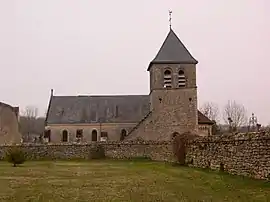 The parish church of St. Vincent, Chemillé-sur-Indrois | |
Location of Chemillé-sur-Indrois | |
 Chemillé-sur-Indrois  Chemillé-sur-Indrois | |
| Coordinates: 47°09′42″N 1°10′00″E / 47.1617°N 1.1667°E | |
| Country | France |
| Region | Centre-Val de Loire |
| Department | Indre-et-Loire |
| Arrondissement | Loches |
| Canton | Loches |
| Intercommunality | CC Loches Sud Touraine |
| Government | |
| • Mayor (2020–2026) | Étienne Arnould[1] |
| Area 1 | 24.87 km2 (9.60 sq mi) |
| Population | 234 |
| • Density | 9.4/km2 (24/sq mi) |
| Time zone | UTC+01:00 (CET) |
| • Summer (DST) | UTC+02:00 (CEST) |
| INSEE/Postal code | 37069 /37460 |
| Elevation | 82–142 m (269–466 ft) |
| 1 French Land Register data, which excludes lakes, ponds, glaciers > 1 km2 (0.386 sq mi or 247 acres) and river estuaries. | |
Chemillé-sur-Indrois (French pronunciation: [ʃəmije syʁ ɛ̃dʁwa], literally Chemillé on Indrois) is a commune in the Indre-et-Loire department, central France.
Geography
The Indrois flows west through the commune and crosses the village.
Population
| Year | Pop. | ±% p.a. |
|---|---|---|
| 1968 | 339 | — |
| 1975 | 273 | −3.05% |
| 1982 | 250 | −1.25% |
| 1990 | 207 | −2.33% |
| 1999 | 197 | −0.55% |
| 2007 | 215 | +1.10% |
| 2012 | 217 | +0.19% |
| 2017 | 222 | +0.46% |
| Source: INSEE[3] | ||
See also
References
- ↑ "Répertoire national des élus: les maires". data.gouv.fr, Plateforme ouverte des données publiques françaises (in French). 2 December 2020.
- ↑ "Populations légales 2021". The National Institute of Statistics and Economic Studies. 28 December 2023.
- ↑ Population en historique depuis 1968, INSEE
Wikimedia Commons has media related to Chemillé-sur-Indrois.
This article is issued from Wikipedia. The text is licensed under Creative Commons - Attribution - Sharealike. Additional terms may apply for the media files.