Becerril de la Sierra | |
|---|---|
 Flag  Seal | |
_mapa.svg.png.webp) Municipal location within the Community of Madrid. | |
| Country | |
| Autonomous community | Community of Madrid |
| Area | |
| • Total | 11.72 sq mi (30.35 km2) |
| Population (2018)[1] | |
| • Total | 5,564 |
| Time zone | UTC+1 (CET) |
| • Summer (DST) | UTC+2 (CEST) |
Becerril de la Sierra (Spanish pronunciation: [beθeˈril de la ˈsjera]) is a municipality of the autonomous community of Madrid in central Spain.[2]
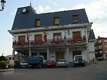
City Hall
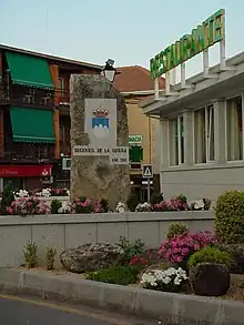
Shield of Becerril de la Sierra
Bus
- 690: Guadarrama - Collado Mediano - Navacerrada
- 696: Collado Villalba (hospital) - Navacerrada
- 724: El Boalo - Manzanares el Real - Colmenar Viejo - Madrid (Plaza de Castilla) (Only the services that come from El Boalo, and only on the way back to Madrid, not on the way to El Boalo)
References
- ↑ Municipal Register of Spain 2018. National Statistics Institute.
- ↑ "BECERRIL DE LA SIERRA (Madrid)". 2013-09-29. Archived from the original on 2013-09-29. Retrieved 2021-02-13.
External links
Wikimedia Commons has media related to Becerril de la Sierra.
40°43′N 3°59′W / 40.717°N 3.983°W
This article is issued from Wikipedia. The text is licensed under Creative Commons - Attribution - Sharealike. Additional terms may apply for the media files.