Collado Villalba
Villalba | |
|---|---|
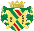
 Flag  Coat of arms | |
_mapa.svg.png.webp) Location in the Community of Madrid, Spain | |
| Coordinates: 40°38′00″N 4°00′30″W / 40.63333°N 4.00833°W | |
| Country | Spain |
| Autonomous community | Community of Madrid |
| Province | Madrid |
| Government | |
| • Mayor | Mariola Vargas (Partido Popular) |
| Area | |
| • Total | 26.5 km2 (10.2 sq mi) |
| Elevation | 917 m (3,009 ft) |
| Population (2018)[1] | |
| • Total | 63,074 |
| • Density | 2,400/km2 (6,200/sq mi) |
| Demonym | Villalbinos/as |
| Time zone | UTC+1 (CET) |
| • Summer (DST) | UTC+2 (CEST) |
| Postal code | 28400 |
| Area code | 34 (Spain) + 91 (Madrid) |
| Website | Official website |
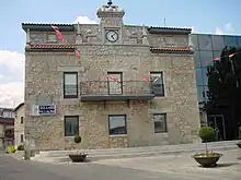
Collado Villalba (Spanish pronunciation: [koˈʎaðo βiˈʎalβa]) is a municipality of the Community of Madrid, in central Spain. It is located 40.3 kilometres north-west of the city of Madrid, at an altitude of 917 meters above sea level. It has a population of 64,263 (2022), with a population density of about 2,400 per km². Collado Villalba has a hot summer Mediterranean climate (Köppen Csa).

Public transport
Train
Collado Villalba has its own train station, which gives service to lines C-3a (Aranjuez - El Escorial - Santa María de la Alameda), C-8 (Guadalajara - Cercedilla) and C-10 (Aeropuerto T-4 - Villalba) of Cercanías Madrid. It also gives service to long distance trains going to Salamanca, Ávila or Valladolid.
Bus
Collado Villalba has many bus lines, most of them connecting the town with Madrid.
- 630: Villalba - Galapagar - Colmenarejo - Valdemorillo
- 660: San Lorenzo de El Escorial - Guadarrama - Villalba
- 670: Villalba Hospital - Moralzarzal
- 671: Madrid (Moncloa) - Moralzarzal
- 672: Madrid (Moncloa) - Cerceda (through Mataelpino)
- 672a: Madrid (Moncloa) - Cerceda
- 673: Madrid (Moncloa) - Villalba
- 680: Alpedrete - Villalba Hospital
- 681: Madrid (Moncloa) - Alpedrete
- 682: Madrid (Moncloa) - Guadarrama
- 683 Madrid (Moncloa) - Collado Mediano
- 684: Madrid (Moncloa) - Guadarrama - Cercedilla
- 685 Majadahonda - Guadarrama
- 687: Madrid (Moncloa) - Villalba (Bus Station)
- 688: Madrid (Moncloa) - Los Molinos
- 691: Madrid (Moncloa) - Becerril de la Sierra - Navacerrada
- 696: Villalba Hospital - Navacerrada
- 720: Colmenar Viejo - Villalba
- 876: Madrid (Plaza de Castilla) - Moralzarzal - Villalba
- Night bus line 602: Madrid (Moncloa) - Villalba
- Night bus line 603: Madrid (Moncloa) - Moralzarzal
- Urban line 1: Train Station - Parque de La Coruña - City Center - Urbanizaciones
- Urban line 2 (circular): Train Station - Parque de La Coruña - Health Center - Los Negrales - Train Station
- Urban line 3: Train Station - El Gorronal - Villalba Hospital
- Urban line 4: Train Station - Parque de La Coruña - City Center
- Urban line 6: Train Station - Cantos Altos - City Center - Arroyo Arriba
See also
External links
- Collado Villalba City Council (in Spanish)
References
- ↑ Municipal Register of Spain 2018. National Statistics Institute.