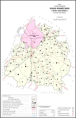
Bela Bhela
Uttarpāra | |
|---|---|
Village | |
 Map showing Bela Bhela (#488) in Rahi CD block | |
 Bela Bhela Location in Uttar Pradesh, India | |
| Coordinates: 26°08′02″N 81°13′37″E / 26.133829°N 81.227067°E[1] | |
| Country | |
| State | Uttar Pradesh |
| District | Raebareli |
| Area | |
| • Total | 21.189 km2 (8.181 sq mi) |
| Population (2011)[2] | |
| • Total | 16,623 |
| • Density | 780/km2 (2,000/sq mi) |
| Languages | |
| • Official | Hindi |
| Time zone | UTC+5:30 (IST) |
| Vehicle registration | UP-35 |
Bela Bhela, also called Uttarpara,[1][3] is a village in Rahi block of Rae Bareli district, Uttar Pradesh, India.[2] It is located 9 km from Rae Bareli, the district headquarters,[4] east of the road to Dalmau.[3] It lies in a belt of stiff clay soil which is highly productive agriculturally and is interspersed with wetlands and patches of barren usar soil.[5] Bela Bhela is a large village consisting of many hamlets.[3] As of 2011, Bela Bhela has a total population of 16,623 people, in 3,004 households.[2] It has one primary school and one medical clinic.[2]
History
At the turn of the 20th century, Bela Bhela was described as a large village whose lands were well-cultivated and "amply" irrigated by several tanks and numerous wells.[3] It had a school and hosted markets twice per week.[3] Bela Bhela then formed the main village in the zamindari estate of Sardar Narain Singh, a descendant of the Punjabi nobleman Maharaja Chhattar Singh.[3] It had previously been part of Rana Beni Madho Bakhsh's lands.[3] The 1901 census recorded a population of 4,803 residents in Bela Bhela; almost all of them were Hindus and many of them belonged to the Ahir community.[3]
The 1951 census recorded Bela Bhela as comprising 32 hamlets, with a total population of 5,429 people (2,774 male and 2,655 female), in 1,154 households and 1,148 physical houses.[5] The area of the village was given as 5,453 acres.[5] 213 residents were literate, 208 male and 5 female.[5] The village was listed as belonging to the pargana of Rae Bareli South and the thana of Jagatpur.[5] The village's primary school had an attendance of 182 students as of 1 January of that year.[5]
The 1961 census recorded Bela Bhela (as "Bela Dhela") as comprising 32 hamlets, with a total population of 6,281 people (3,236 male and 3,045 female), in 1,344 households and 1,240 physical houses.[6] The area of the village was given as 5,453 acres and it had a medical practitioner at that point.[6]
The 1981 census recorded Bela Bhela as having a population of 9,003 people, in 1,170 households, and having an area of 2,154.61 hectares.[4] The main staple foods were listed as wheat and rice.[4]
The 1991 census recorded Bela Bhela as having a total population of 11,334 people (5,970 male and 5,364 female), in 2,058 households and 2,044 physical houses.[7] The area of the village was listed as 2,066 hectares.[7] Members of the 0-6 age group numbered 2,306, or 20% of the total; this group was 50% male (1,162) and 50% female (1,144).[7] Members of scheduled castes numbered 2,930, or 26% of the village's total population, while no members of scheduled tribes were recorded.[7] The literacy rate of the village was 25% (2,203 men and 618 women).[7] 3,969 people were classified as main workers (3,105 men and 864 women), while 580 people were classified as marginal workers (35 men and 545 women); the remaining 6,785 residents were non-workers.[7] The breakdown of main workers by employment category was as follows: 2,768 cultivators (i.e. people who owned or leased their own land); 634 agricultural labourers (i.e. people who worked someone else's land in return for payment); 33 workers in livestock, forestry, fishing, hunting, plantations, orchards, etc.; 0 in mining and quarrying; 17 household industry workers; 139 workers employed in other manufacturing, processing, service, and repair roles; 30 construction workers; 99 employed in trade and commerce; 51 employed in transport, storage, and communications; and 198 in other services.[7]
References
- 1 2 "Geonames Search". Search for "Bela Bhela" here.
- 1 2 3 4 5 "Census of India 2011: Uttar Pradesh District Census Handbook - Rae Bareli, Part A (Village and Town Directory)" (PDF). Census 2011 India. pp. 219–43. Retrieved 10 August 2021.
- 1 2 3 4 5 6 7 8 Nevill, H.R. (1905). Rai Bareli: A Gazetteer, Being Volume XXXIX Of The District Gazetteers Of The United Provinces Of Agra And Oudh. Allahabad: Government Press. pp. 9, 158–9. Retrieved 10 August 2021.
- 1 2 3 Census 1981 Uttar Pradesh: District Census Handbook Part XIII-A: Village & Town Directory, District Rae Bareli (PDF). 1982. pp. 98–9. Retrieved 10 August 2021.
- 1 2 3 4 5 6 Census of India, 1951: District Census Handbook Uttar Pradesh (42 - Rae Bareli District) (PDF). Allahabad. 1955. pp. i, 140–1, 211. Retrieved 3 November 2021.
{{cite book}}: CS1 maint: location missing publisher (link) - 1 2 Census 1961: District Census Handbook, Uttar Pradesh (39 - Raebareli District) (PDF). Lucknow. 1965. pp. xlviii-xlix of section "Rae Bareli Tahsil". Retrieved 10 August 2021.
{{cite book}}: CS1 maint: location missing publisher (link) - 1 2 3 4 5 6 7 Census 1991 Series-25 Uttar Pradesh Part-XII B Village & Townwise Primary Census Abstract District Census Handbook District Raebareli (PDF). 1992. pp. xxiv–xxviii, 134–5. Retrieved 21 October 2021.