Newada
Newāda | |
|---|---|
Village | |
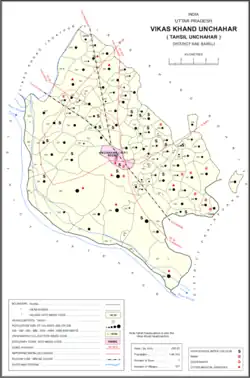 Map showing Newada (#208) in Unchahar CD block | |
 Newada Location in Uttar Pradesh, India | |
| Coordinates: 25°58′47″N 81°17′37″E / 25.979826°N 81.29371°E[1] | |
| Country India | |
| State | Uttar Pradesh |
| District | Raebareli |
| Area | |
| • Total | 1.205 km2 (0.465 sq mi) |
| Population (2011)[2] | |
| • Total | 814 |
| • Density | 680/km2 (1,700/sq mi) |
| Languages | |
| • Official | Hindi |
| Time zone | UTC+5:30 (IST) |
| Vehicle registration | UP-35 |
Newada is a village in Unchahar block of Raebareli district, Uttar Pradesh, India.[2] It is located 29 km from Raebareli, the district headquarters.[3] As of 2011, it has a population of 814 people, in 137 households.[2]
The 1961 census recorded Newada as comprising 2 hamlets, with a total population of 369 people (189 male and 190 female), in 77 households and 72 physical houses.[4] The area of the village was given as 149 acres.[4]
The 1981 census recorded Newada as having a population of 427 people, in 105 households, and having an area of 57.17 hectares.[3] The main staple foods were listed as wheat and rice.[3]
References
- ↑ "GeoNames Search". geonames.nga.mil. Archived from the original on 12 April 2014.
- 1 2 3 4 "Census of India 2011: Uttar Pradesh District Census Handbook - Rae Bareli, Part A (Village and Town Directory)" (PDF). Census 2011 India. pp. 306–30. Retrieved 22 August 2021.
- 1 2 3 Census 1981 Uttar Pradesh: District Census Handbook Part XIII-A: Village & Town Directory, District Rae Bareli (PDF). 1982. pp. 228–9. Retrieved 22 August 2021.
- 1 2 Census 1961: District Census Handbook, Uttar Pradesh (39 - Raebareli District) (PDF). Lucknow. 1965. pp. cxvi-cxvii of section "Salon Tahsil". Retrieved 22 August 2021.
{{cite book}}: CS1 maint: location missing publisher (link)
This article is issued from Wikipedia. The text is licensed under Creative Commons - Attribution - Sharealike. Additional terms may apply for the media files.