Sareni | |
|---|---|
Village | |
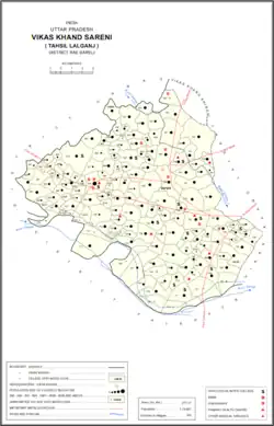 Map of Sareni CD block | |
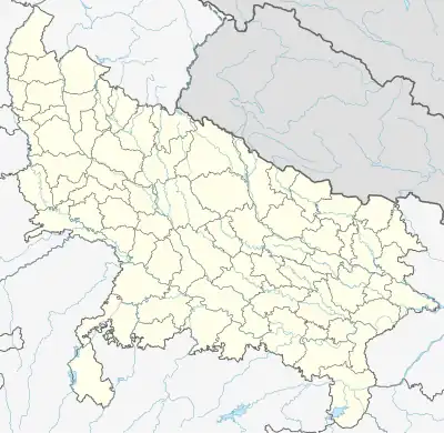 Sareni Location in Uttar Pradesh, India | |
| Coordinates: 26°08′57″N 80°49′44″E / 26.149112°N 80.828787°E[1] | |
| Country | |
| State | Uttar Pradesh |
| District | Raebareli |
| Area | |
| • Total | 4.523 km2 (1.746 sq mi) |
| Population (2011)[2] | |
| • Total | 4,819 |
| • Density | 1,100/km2 (2,800/sq mi) |
| Languages | |
| • Official | Hindi |
| Time zone | UTC+5:30 (IST) |
| Vehicle registration | UP-33 |
Sareni is a village and corresponding community development block in Lalganj tehsil of Rae Bareli district, Uttar Pradesh, India.[2] Historically the seat of a pargana,[3] it is located 18 km from Lalganj, the tehsil headquarters,[4] on the road to Daundia Khera in Unnao district.[3] As of 2011, Sareni has a population of 4,819 people, in 792 households.[2] It has 3 primary schools and no healthcare facilities.[2] It serves as the headquarters of a nyaya panchayat which also includes 10 other villages.[5]
History
Sareni was supposedly first founded by a member of the Bais clan named Sarang Sah.[3] It was first made headquarters of a pargana and tehsil during the reign of Saadat Ali Khan (which one is not specified in the source).[3] Previously, the pargana had been part of four different mahals: Kahanjara, Nisgar, Deorakh, and Tara Singhaur.[3]
At the turn of the 20th century, Sareni had a police station, a post office, a cattle pound, and a large primary school.[3] It was held in taluqdari tenure by the Rana of Khajurgaon, as part of the Murarmau estate.[3] The population in 1901 was 1,458, including a Muslim minority of 202.[3]
The 1951 census recorded Sareni as comprising 7 hamlets, with a total population of 1,466 people (779 male and 687 female), in 281 households and 149 245 houses.[6] The area of the village was given as 1,197 acres.[6] 153 residents were literate, 147 male and 6 female.[6] The village was listed as belonging to the pargana of Sareni and the thana of Sareni.[6]
The 1961 census recorded Sareni as comprising 5 hamlets, with a total population of 1,883 people (955 male and 928 female), in 334 households and 290 physical houses.[7] The area of the village was given as 1,197 acres and it had a medical practitioner and post office at that point.[7] It also had the following small industrial establishments: 1 grain mill, 1 maker of clothing, 2 makers of wooden products not further classified, and 1 maker of jewellery or precious metal items.[7] The village's police staff consisted of 2 sub-inspectors, 1 head constable, and 14 constables.[7]
The 1981 census recorded Sareni as having a population of 2,575 people, in 414 households, and having an area of 457.70 hectares.[4] The main staple foods were given as wheat and rice.[4]
The 1991 census recorded Sareni as having a total population of 3,419 people (1,777 male and 1,642 female), in 583 households and 583 physical houses.[5] The area of the village was listed as 458 hectares.[5] Members of the 0-6 age group numbered 707, or 21% of the total; this group was 56% male (396) and 44% female (311).[5] Members of scheduled castes made up 19% of the village's population, while no members of scheduled tribes were recorded.[5] The literacy rate of the village was 40% (950 men and 406 women).[5] 919 people were classified as main workers (786 men and 133 women), while 2 people were classified as marginal workers (both women); the remaining 2,498 residents were non-workers.[5] The breakdown of main workers by employment category was as follows: 280 cultivators (i.e. people who owned or leased their own land); 253 agricultural labourers (i.e. people who worked someone else's land in return for payment); 2 workers in livestock, forestry, fishing, hunting, plantations, orchards, etc.; 0 in mining and quarrying; 38 household industry workers; 66 workers employed in other manufacturing, processing, service, and repair roles; 4 construction workers; 133 employed in trade and commerce; 9 employed in transport, storage, and communications; and 134 in other services.[5]
Villages
Sareni CD block has the following 160 villages:[2]
| Village name | Total land area (hectares) | Population (in 2011) |
|---|---|---|
| Samodha | 183.8 | 1,604 |
| Ibrahimpur | 12.2 | 2,372 |
| Deopur | 144 | 1,737 |
| Kahinjar | 225.8 | 2,099 |
| Umrapur | 54.4 | 675 |
| Lakhai Khera | 106.2 | 327 |
| Ranjeetpur | 154.4 | 1,122 |
| Daspur | 124.5 | 7 |
| Kaji Khera | 41.1 | 1,215 |
| Ram Khera | 100.8 | 896 |
| Rasulpur | 127.9 | 1,343 |
| Binnawan | 89.2 | 485 |
| Rahim Khera | 72.6 | 440 |
| Chandpur | 132 | 128 |
| Sabji Babura | 283 | 1,724 |
| Khaund | 6.6 | 893 |
| Pithupur | 88.7 | 928 |
| Prem Chak | 296.2 | 2,535 |
| Pahuri | 588 | 4,190 |
| Kushal Khera | 76.1 | 514 |
| Ghure Mau | 496.4 | 4,072 |
| Sotawa Khera | 59.9 | 1,244 |
| Surjapur | 56.4 | 866 |
| Khanpur | 127.8 | 1,058 |
| Murar Mau | 336.1 | 2,999 |
| Hullapur | 240.7 | 1,864 |
| Kondara | 112.5 | 1,334 |
| Mahrajpur | 82.6 | 526 |
| Rampur Khurd | 41 | 303 |
| Mangadpur | 68.3 | 403 |
| Kati Khaa | 164.7 | 1,141 |
| Rani Khera | 118.7 | 1,451 |
| Bithuli | 108.8 | 456 |
| Palti Khera | 333.6 | 2,641 |
| Barvaliya | 224.2 | 1,799 |
| Gajpati Khera | 82.4 | 1,273 |
| Tal Kataila | 284.6 | 471 |
| Lalpur | 46.2 | 510 |
| Chhatauna | 75.9 | 1,002 |
| Dundi | 58.4 | 476 |
| Bhojpur | 474.9 | 7,173 |
| Nijam Khera | 60.9 | 222 |
| Usuru | 617.4 | 3,428 |
| Madnapur | 90.9 | 342 |
| Pathak Khera | 50.3 | 566 |
| Tiwaripur Kalan | 96 | 1,001 |
| Patakpur Urf Ranapur | 99.2 | 618 |
| Jai Gopalpur | 25.7 | 7 |
| Tiwaripur Khurd | 66.9 | 338 |
| Terui | 40.1 | 53 |
| Mohanpur | 28.5 | 285 |
| Durjanpur | 49 | 464 |
| Bhawa Khera | 58.4 | 315 |
| Chak Kantu | 24 | 0 |
| Sahide Mau | 71.3 | 343 |
| Mailaspur | 87.6 | 403 |
| Jarwal | 80.7 | 464 |
| Kheman Khera | 95.4 | 584 |
| Chandraman Khera | 57.1 | 485 |
| Basu Khera | 59.5 | 0 |
| Jhulpur | 119.3 | 676 |
| Chahotar | 267.5 | 2,063 |
| Madhopur | 211.7 | 1,702 |
| Sarhapur | 74.6 | 245 |
| Gandu Mau | 9.6 | 21 |
| Daulatpur | 99.2 | 553 |
| Chinta Khera | 121.8 | 741 |
| Haibatpur Khurd | 88 | 770 |
| Lachhai Khera | 52.8 | 1,239 |
| Rajapur | 62.8 | 266 |
| Dalipur | 62.1 | 331 |
| Gosa Khera | 20.4 | 322 |
| Chak Kanti | 32.6 | 156 |
| Haripur Mu. | 163.4 | 1,474 |
| Haripur Aht. | 304.5 | 6 |
| Bhupatpur Mu. | 31.7 | 8 |
| Bhupatpur Aht. | 208.8 | 22 |
| Gahrauli Mu. | 272.1 | 3,336 |
| Gahrauli Aht. | 221.5 | 0 |
| Purushottampur Mu. | 146.6 | 161 |
| Purushottampur Aht. | 105.2 | 0 |
| Kotiya Aht. | 1,078.4 | 2,101 |
| Nisgaraht. | 850.1 | 0 |
| Nisgar Mu. | 339.3 | 2,352 |
| Kasba Badlu | 104.8 | 695 |
| Kashi Khera | 63.2 | 708 |
| Bisayakpur | 128.5 | 1,055 |
| Nibi | 256.9 | 1,708 |
| Dulapur | 260.4 | 1,950 |
| Rawatpur Kalan | 106.1 | 2,009 |
| Jagannathpur Mu. | 146.3 | 644 |
| Jagannathpur Aht. | 10 | 0 |
| Alipur Mu. | 125.4 | 73 |
| Alipur Aht. | 23 | 0 |
| Puranpur | 83.5 | 491 |
| Sarai Khande Mu. | 306.3 | 1,667 |
| Sarai Khande Aht. | 305.6 | 0 |
| Gonda | 117.1 | 723 |
| Saidapur | 95.1 | 1,064 |
| Dudhwan | 356.6 | 2,638 |
| Raipur | 204.4 | 1,672 |
| Bahupur | 97.6 | 512 |
| Hamir Gaon | 812 | 2,700 |
| Ghuri Khera | 78.1 | 580 |
| Bhawanipur | 110.5 | 623 |
| Chhamani Khera | 42 | 352 |
| Murdipur Majhigawa | 93.3 | 1,222 |
| Govindpur | 248.2 | 1,525 |
| Bahadurpur | 106.4 | 1,624 |
| Sareni (block headquarters) | 452.3 | 4,819 |
| Lakhanapur | 197.3 | 2,447 |
| Madai Khera | 185 | 1,322 |
| Dhagaicha | 90.9 | 646 |
| Hasanapur | 786.4 | 1,120 |
| Chak Maniya | 69.3 | 486 |
| Gautamman Khera | 47.2 | 600 |
| Ramaipur Kalan | 243.1 | 1,579 |
| Dhanpalpur | 245.2 | 2,552 |
| Jhampur | 197.7 | 1,126 |
| Hathnasa | 191.5 | 3,247 |
| Tej Gaon | 480.8 | 4,431 |
| Dariyapur | 127.5 | 655 |
| Chak Gaur | 92.2 | 579 |
| Pasan Khera | 48.4 | 671 |
| Malke Gaon | 305.8 | 2,951 |
| Lakhan Gaon | 138.3 | 1,233 |
| Baruwahar | 100 | 768 |
| Parwat Khera | 51.7 | 437 |
| Odarahar | 193.2 | 414 |
| Dighiya | 71 | 730 |
| Chak Chorhiya | 94.3 | 896 |
| Gajiyapur | 35.1 | 420 |
| Saidapur) | 175.3 | 1,405 |
| Rasi Gaon | 239.6 | 1,727 |
| Chhivlaha | 325.5 | 3,241 |
| Mathurpur Mu. | 249 | 1,393 |
| Mathurpur Aht. | 337 | 1 |
| Dafpura | 92.5 | 516 |
| Rampur Kalan Aht. | 167.9 | 0 |
| Rampur Kalan Mu. | 399.5 | 2,579 |
| Bairuwa Aht. | 322.1 | 0 |
| Bairuwa Mu | 330.3 | 2,138 |
| Sahanipur | 161.8 | 1,372 |
| Firojpur | 128.4 | 505 |
| Helauli | 115.6 | 561 |
| Haibatpur Kalan | 180.3 | 1,424 |
| Rautapur | 106 | 579 |
| Ralpur Aht. | 200.9 | 0 |
| Ralpur Mu. | 591.4 | 4,749 |
| Kanjas | 174.9 | 1,023 |
| Bhita | 37.8 | 524 |
| Deo Khera | 208.6 | 153 |
| Kalhi Gaon | 89 | 1,348 |
| Ram Gaon | 68.6 | 506 |
| Gopali Khera | 130.8 | 610 |
| Sagar Khera | 201.6 | 2,102 |
| Ramaipur Khurd | 76.9 | 638 |
| Sidhaur Tara Aht. | 40.6 | 1 |
| Sidhaur Tara Mu. | 411 | 1,707 |
| Musapur | 292 | 1,944 |
References
- ↑ "GeoNames Search". geonames.nga.mil. Archived from the original on 12 April 2014. Retrieved 13 June 2023.
- 1 2 3 4 5 6 "Census of India 2011: Uttar Pradesh District Census Handbook - Rae Bareli, Part A (Village and Town Directory)" (PDF). Census 2011 India. pp. 262–87. Retrieved 13 August 2021.
- 1 2 3 4 5 6 7 8 Nevill, H.R. (1905). Rai Bareli: A Gazetteer, Being Volume XXXIX Of The District Gazetteers Of The United Provinces Of Agra And Oudh. Allahabad: Government Press. pp. 221–2. Retrieved 13 August 2021.
- 1 2 3 Census 1981 Uttar Pradesh: District Census Handbook Part XIII-A: Village & Town Directory, District Rae Bareli (PDF). 1982. pp. 138–9. Retrieved 13 August 2021.
- 1 2 3 4 5 6 7 8 Census 1991 Series-25 Uttar Pradesh Part-XII B Village & Townwise Primary Census Abstract District Census Handbook District Raebareli (PDF). 1992. pp. xxiv–xxviii, 176–7. Retrieved 22 October 2021.
- 1 2 3 4 Census of India, 1951: District Census Handbook Uttar Pradesh (42 - Rae Bareli District) (PDF). Allahabad. 1955. pp. 118–9. Retrieved 22 October 2021.
{{cite book}}: CS1 maint: location missing publisher (link) - 1 2 3 4 Census 1961: District Census Handbook, Uttar Pradesh (39 - Raebareli District) (PDF). Lucknow. 1965. pp. 141, lxxiv-lxxv of section "Dalmau Tahsil", cxxiv–cxxvi. Retrieved 13 August 2021.
{{cite book}}: CS1 maint: location missing publisher (link)