Bijar County
Persian: شهرستان بیجار | |
|---|---|
County | |
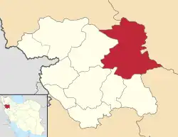 Location of Bijar County in Kurdistan province | |
 Location of Kurdistan province in Iran | |
| Coordinates: 35°38′N 47°40′E / 35.633°N 47.667°E[1] | |
| Country | |
| Province | Kurdistan |
| Capital | Bijar |
| Districts | Central, Chang Almas, Korani |
| Population (2016)[2] | |
| • Total | 89,162 |
| Time zone | UTC+3:30 (IRST) |
| Bijar County can be found at GEOnet Names Server, at this link, by opening the Advanced Search box, entering "9206623" in the "Unique Feature Id" form, and clicking on "Search Database". | |
Bijar County (Persian: شهرستان بیجار; Kurdish: شارستانی بیجاڕ) is in Kurdistan province, Iran. Its capital is the city of Bijar. The people of the city are Kurds and speak Kurdish language.
At the 2006 census, the county's population was 95,461 in 23,614 households.[3] The following census in 2011 counted 93,714 people in 26,068 households.[4] At the 2016 census, the county's population was 89,162 in 27,759 households.[2]
Administrative divisions
The population history and structural changes of Bijar County's administrative divisions over three consecutive censuses are shown in the following table. The latest census shows three districts, 11 rural districts, and five cities.[2]
| Administrative Divisions | 2006[3] | 2011[4] | 2016[2] |
|---|---|---|---|
| Central District | 66,833 | 66,962 | 65,888 |
| Howmeh RD | 4,081 | 3,817 | 3,352 |
| Khvor Khvoreh RD | 4,622 | 3,922 | 3,462 |
| Najafabad RD | 3,455 | 3,145 | 2,724 |
| Seylatan RD | 4,828 | 4,861 | 1,932 |
| Siyah Mansur RD | 3,691 | 3,291 | 2,759 |
| Bijar (city) | 46,156 | 47,926 | 50,014 |
| Tup Aghaj (city) | 1,645 | ||
| Chang Almas District | 14,357 | 13,137 | 10,737 |
| Babarashani RD | 3,178 | 2,886 | 2,050 |
| Khosrowabad RD | 4,319 | 3,741 | 3,134 |
| Pir Taj RD | 6,379 | 5,937 | 3,845 |
| Babarashani (city) | 481 | 573 | 509 |
| Pir Taj (city) | 1,199 | ||
| Korani District | 14,271 | 13,615 | 12,537 |
| Gorgin RD | 2,447 | 2,065 | 1,997 |
| Korani RD | 4,775 | 4,463 | 3,913 |
| Taghamin RD | 3,781 | 3,303 | 3,137 |
| Yasukand (city) | 3,268 | 3,784 | 3,490 |
| Total | 95,461 | 93,714 | 89,162 |
| RD: Rural District | |||
Wikimedia Commons has media related to Bijar County.
References
- ↑ OpenStreetMap contributors (16 August 2023). "Bijar County" (Map). OpenStreetMap. Retrieved 16 August 2023.
- 1 2 3 4 "Census of the Islamic Republic of Iran, 1395 (2016)". AMAR (in Persian). The Statistical Center of Iran. p. 12. Archived from the original (Excel) on 8 May 2022. Retrieved 19 December 2022.
- 1 2 "Census of the Islamic Republic of Iran, 1385 (2006)". AMAR (in Persian). The Statistical Center of Iran. p. 12. Archived from the original (Excel) on 20 September 2011. Retrieved 25 September 2022.
- 1 2 "Census of the Islamic Republic of Iran, 1390 (2011)" (Excel). Iran Data Portal (in Persian). The Statistical Center of Iran. p. 12. Retrieved 19 December 2022.
Kurdistan Province, Iran | |||||||||||||||||||||
|---|---|---|---|---|---|---|---|---|---|---|---|---|---|---|---|---|---|---|---|---|---|
| Capital |  | ||||||||||||||||||||
| Counties and cities |
| ||||||||||||||||||||
| Sights |
| ||||||||||||||||||||
| populated places | |||||||||||||||||||||
This article is issued from Wikipedia. The text is licensed under Creative Commons - Attribution - Sharealike. Additional terms may apply for the media files.